Tractor GPS Guidance: Wholesale Price & Factory Direct Sale

Tractor GPS guidance

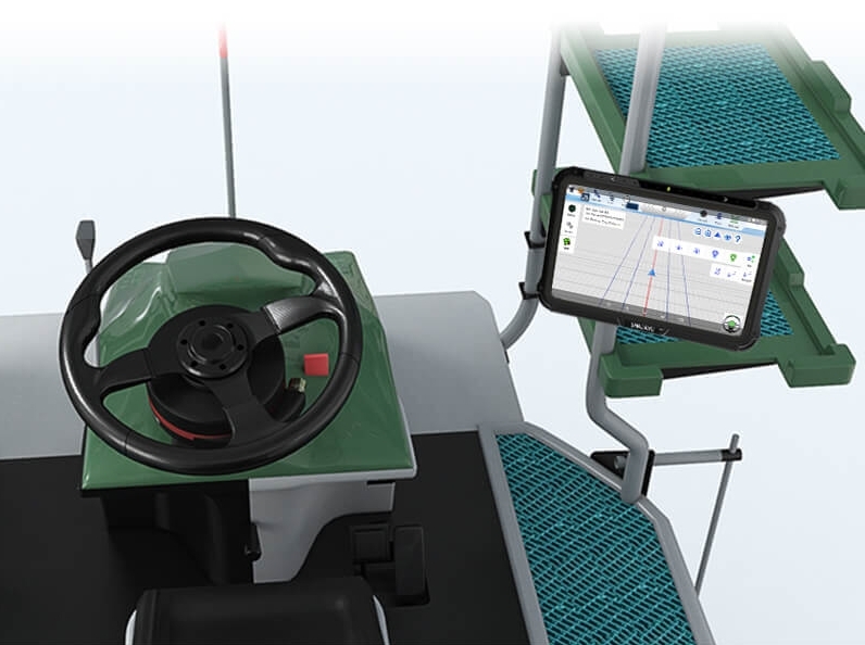
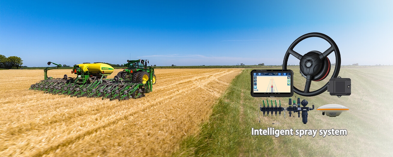
As the agricultural sector continues to evolve, technology has become an important tool for farmers. Among the various advancements that have transformed the industry, Tractor GPS Guidance stands out as a game-changer. This technology has not only increased productivity but has also optimized resource utilization, ultimately leading to improved yields.  For agricultural distributors seeking the best ... Read more

GNSS Survey Equipment: 2023 Best Wholesale Choice

gps sprayer guidance

Global Navigation Satellite System (GNSS) survey equipment has become the cornerstone of modern surveying and mapping applications. These high-tech instruments have revolutionized the way we collect geospatial data, offering unparalleled accuracy and efficiency. When it comes to GNSS survey equipment, SMAJAYU is a reputable manufacturer known for its commitment to quality and precision. Their equipment ... Read more

Unlocking Precision and Efficiency: Exploring Topografia GNSS Equipment

Topografia GNSS Equipment 

Global Navigation Satellite System (GNSS) technology has revolutionized gathering geospatial data. It plays a crucial role in various industries, from surveying and mapping to agriculture and construction. Topografia stands out as a leader in delivering precision and efficiency among the many GNSS equipment providers. In this article, we will delve into the world of Topografia ... Read more

RTK GPS Topography Surveying: Modernizing Surveying Practices

RTK GPS Topography Surveying

Technological advancements in land surveying have continually reshaped how professionals collect accurate data about the Earth's surface. Among these innovations, Real-Time Kinematic (RTK) Global Positioning System (GPS) technology has emerged as a game-changer. RTK GPS Topography Surveying is revolutionizing the field, offering precision, efficiency, and versatility that were previously modernized. This article will explore how RTK ... Read more

Revolutionizing Farming: Tractor GPS Land Levelling System

GPS Land Levelling system 

In the modern era of agriculture, technology has played a pivotal role in enhancing productivity, efficiency, and sustainability. Among the innovations transforming farming practices, the Tractor GPS Land Levelling System stands out as a game-changer. This revolutionary technology has revolutionized how farmers prepare their fields, ensuring precision and consistency in land leveling processes. This article will ... Read more

GPS Survey Equipment: Charting a Course to Accuracy

GPS Survey Equipment

In the realm of modern surveying, accuracy is paramount. For construction, land management, cartography, or even archaeological exploration, precise location data is the cornerstone of reliable results. This is where GPS survey equipment steps in, revolutionizing how we gather geographic information. This comprehensive exploration delves into GPS survey equipment and its pivotal role in surveying applications. ... Read more

Precision Mapping: The Art of GPS Topography Survey

GPS Topography Survey

In modern technology, precision mapping has emerged as an indispensable tool for various industries, from construction and urban planning to environmental conservation and archaeology. Among the techniques employed for precision mapping, Global Positioning System (GPS) topography surveys are highly accurate and versatile. This article delves into the intricacies of GPS topography survey, exploring their applications, the ... Read more

Exploring the World with GPS Rovers

GPS Rovers

In a world characterized by rapid technological advancements, using GPS rovers has revolutionized how we explore and navigate our planet. These remarkable devices have found their way into various industries and have become indispensable tools for adventurers, scientists, surveyors, and many others. In this article, we will explore the world of GPS rovers, exploring their ... Read more

Enhancing Land Development Projects with RTK Topografia

RTK Topografia

In the world of land development, precision is paramount. Whether you're constructing a towering skyscraper in a bustling metropolis or crafting a serene residential community in a quiet suburb, the success of your project hinges on accurate measurements and data. Real-Time Kinematic (RTK) Topografia, a cutting-edge geospatial technology, has emerged as a game-changer in land ... Read more