

In modern technology, precision mapping has emerged as an indispensable tool for various industries, from construction and urban planning to environmental conservation and archaeology. Among the techniques employed for precision mapping, Global Positioning System (GPS) topography surveys are highly accurate and versatile. This article delves into the intricacies of GPS topography survey, exploring their applications, the technology behind them, and their significance in shaping our world.
What is a GPS Topography Survey?
GPS topography survey is a specialized land surveying form that utilizes the Global Positioning System. The goal is to create highly accurate, three-dimensional maps of the Earth’s surface. Unlike traditional surveying methods that rely on theodolites and tape measures, GPS surveys are conducted using a network of satellites orbiting the Earth. These satellites transmit signals received by GPS receivers on the ground, allowing surveyors to pinpoint their exact location with remarkable precision.
The Role of Satellites:
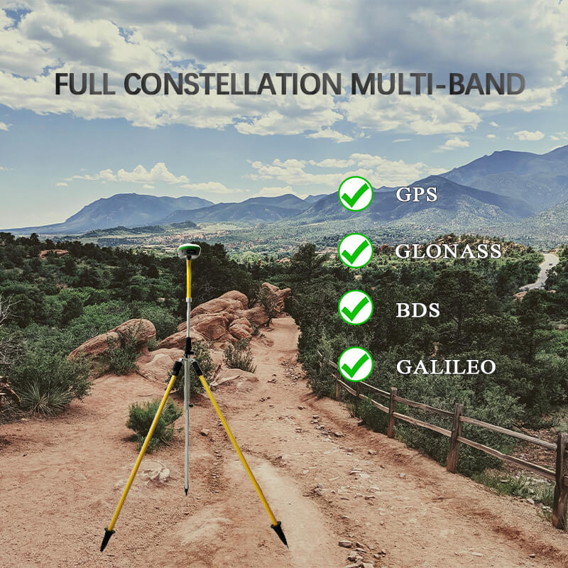
At the heart of the GPS topography survey is a satellite constellation, typically maintained by government agencies such as the United States GPS, Russia’s GLONASS, and Europe’s Galileo. These satellites continuously broadcast signals containing precise time and location information. A GPS receiver on the ground intercepts these signals from multiple satellites. It uses the time it takes for each signal to arrive to calculate its exact position in three-dimensional space.
The more satellites a GPS receiver can connect with, the more accurate its position calculation becomes. This is known as trilateration, a process similar to triangulation but operating in three dimensions. The accuracy of modern GPS surveys can be as precise as a few millimeters, making them invaluable for various applications that demand high levels of accuracy.
Types of GPS Receivers Used in Topography Surveys:
- Single-Frequency GPS Receivers: These receivers are the most basic and affordable option. They can determine position with sub-meter accuracy, making them suitable for general mapping tasks and navigation.
- Dual-Frequency GPS Receivers: Dual-frequency receivers offer greater accuracy by mitigating atmospheric errors. They are often used in demanding applications like geodetic surveys and construction layouts.
- RTK GPS Receivers: RTK receivers provide real-time centimeter-level accuracy. They rely on a reference station to correct satellite signal errors. RTK is preferred for highly precise surveys like land parcel mapping and construction site layout.
- Post-Processing GPS Receivers: These receivers collect raw data that is later processed to improve accuracy. While not suited for real-time applications, they are ideal for research and projects where the highest level of precision is required.
- GNSS Receivers: GNSS (Global Navigation Satellite System) receivers are compatible with multiple satellite constellations, such as GPS, GLONASS, and Galileo. This redundancy enhances reliability and accuracy in challenging environments like urban canyons or dense forests.
- Network GPS Receivers: These receivers rely on a network of base stations that continuously transmit correction data. Surveyors can access this data online, achieving high precision even in remote locations.
The choice of GPS receiver depends on the project’s specific requirements, budget, and environmental conditions. In topography surveys, accuracy is paramount, and selecting the appropriate receiver is critical.
Applications of GPS Topography Surveys:
GPS topography surveys find applications in numerous fields, each benefiting from the precision and efficiency they offer. Here are some key areas where these surveys play a crucial role:
- Construction and Engineering: Accuracy is paramount in construction and civil engineering projects. GPS topography survey enables engineers to create detailed site plans, ensuring that buildings, roads, bridges, and other infrastructure are constructed exactly as designed. This reduces errors, saves time, and minimizes costs.
- Agriculture: The agricultural industry uses precision mapping to optimize crop yields and manage resources efficiently. GPS surveys help farmers map their fields, monitor soil conditions, and plan irrigation systems, leading to more sustainable and profitable farming practices.
- Environmental Conservation: Conservationists and ecologists use GPS surveys to map and monitor ecosystems, track wildlife movements, and assess the impact of human activities on the environment. This information is vital for making informed decisions regarding conservation efforts and land management.
- Urban Planning: GPS topography surveys aid land-use planning, transportation network design, and infrastructure development in rapidly growing urban areas. They help city planners make informed decisions that promote sustainable urban development.
- Archaeology: Archaeologists rely on precision mapping to document archaeological sites and excavations accurately. GPS surveys help preserve the historical record and ensure that artifacts and structures are recorded in their correct locations.
- Disaster Management: During and after natural disasters, such as earthquakes and floods, GPS surveys assist emergency responders and relief agencies in assessing damage and coordinating response efforts. Accurate maps can be quickly generated to aid in evacuation and rescue operations.
The Technology Behind GPS Topography Surveys:
To fully appreciate the art of GPS topography surveys, it’s essential to understand the technology that makes them possible. Here are the key components of GPS surveying technology:
- GPS Receivers: GPS receivers are the handheld or mounted devices surveyors use to collect data. These receivers capture signals from multiple satellites and determine their precise location. High-precision receivers are often equipped with multiple antennae to improve accuracy.
- Satellite Constellations: As mentioned earlier, various satellite constellations, such as GPS, GLONASS, and Galileo, provide signals for GPS surveying. These constellations work together to ensure global coverage, allowing surveyors to conduct precision mapping anywhere on Earth.
- Differential GPS: DGPS is a technique used to further enhance the accuracy of GPS surveys. It involves a base station with a known location that continuously tracks GPS signals. The base station’s known position is used to correct the measurements of roving GPS receivers, significantly improving accuracy, especially in real-time applications.
- Geodetic Control Points: Geodetic control points are precisely surveyed locations that serve as reference points for GPS surveys. Surveyors use these points to establish a stable and accurate reference frame for their measurements, ensuring the consistency and reliability of their results.
Conclusion:
GPS topography survey has revolutionized the way we map and understand our world. Their precision and versatility have made them indispensable tools across various industries, from construction and agriculture to environmental conservation and disaster management. With advancements in technology and techniques, the accuracy and efficiency of GPS surveys continue to improve, shaping the future of precision mapping and its role in shaping our world. To ensure your precision mapping needs are met with the highest quality, consider choosing SMAJAYU, a trusted provider in the field.
