


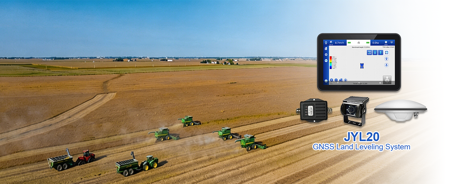
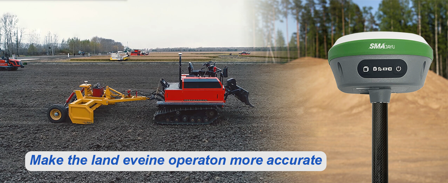
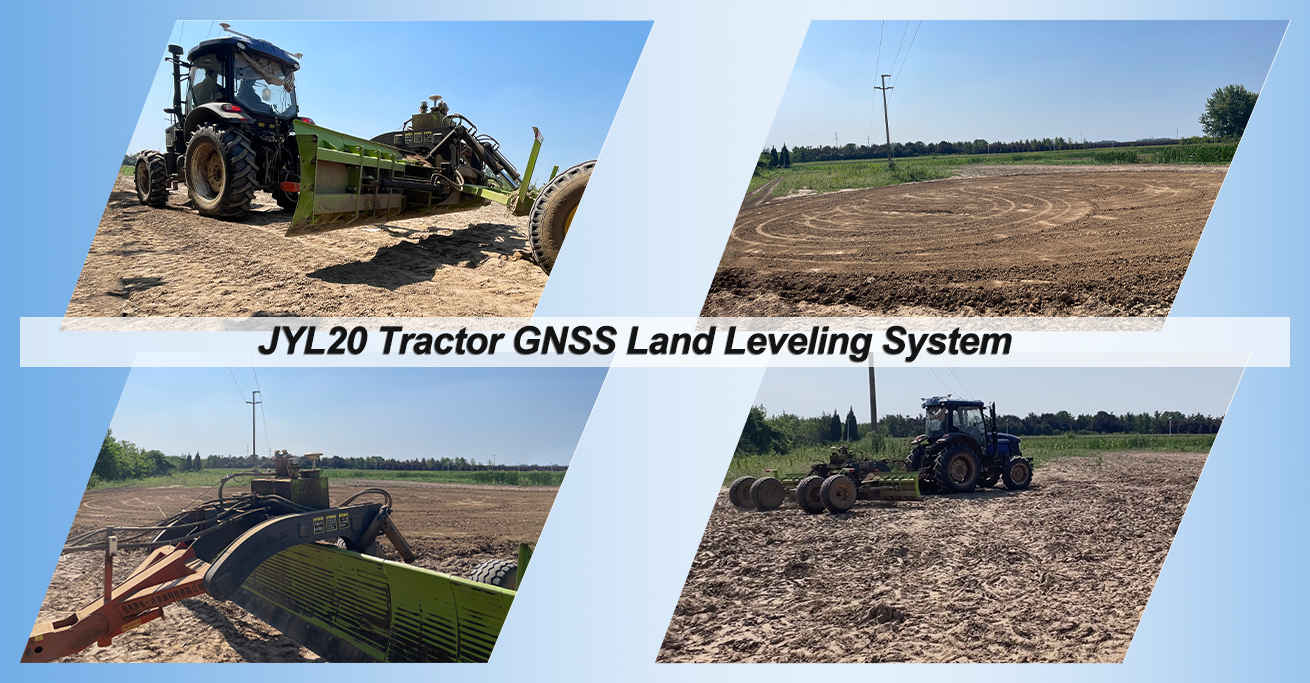
JYL20 Tractor GNSS Land Leveling System with SMA26 PRO RTK base station
$2,800.00
Stars,100% Recommend
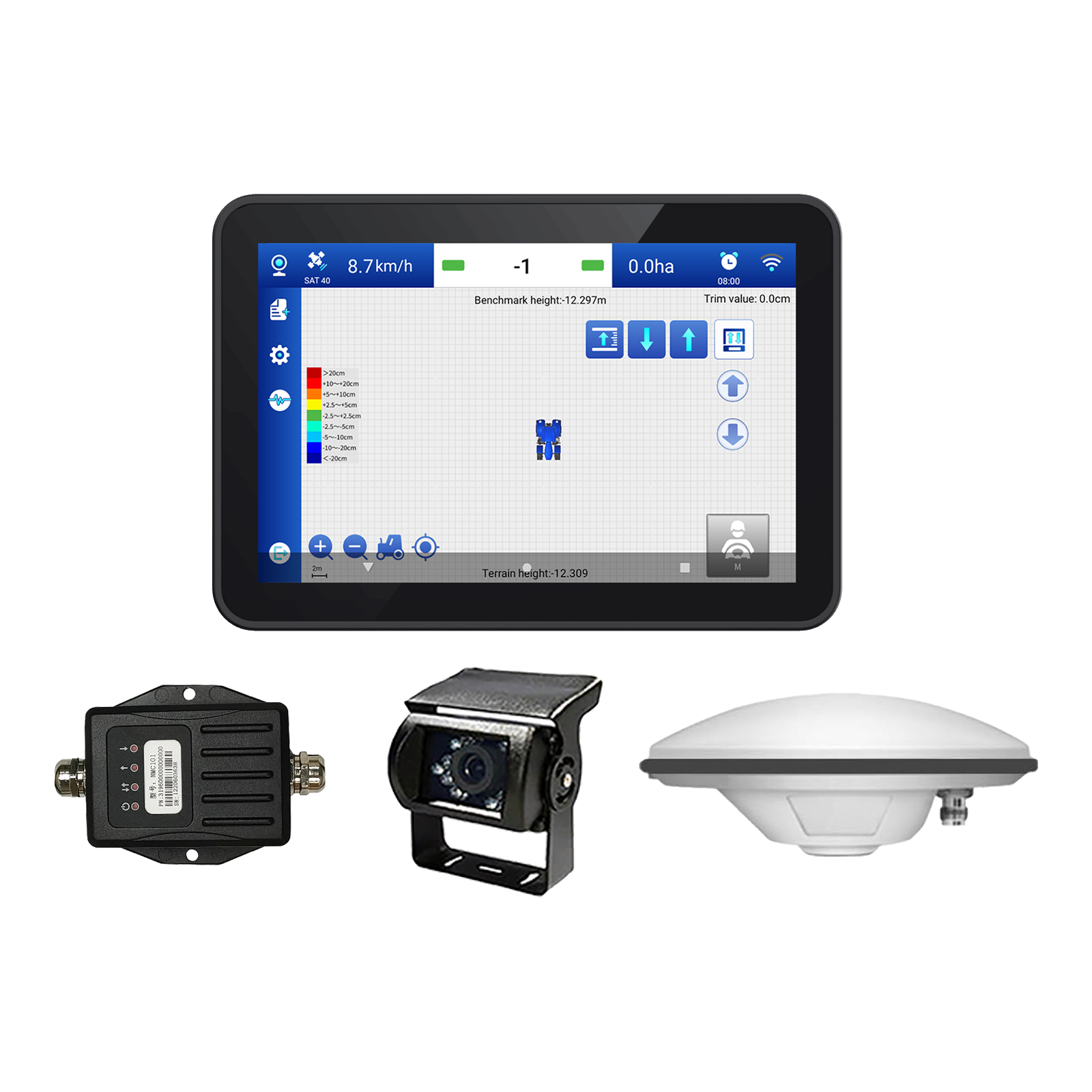
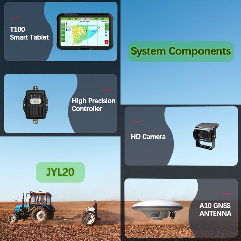
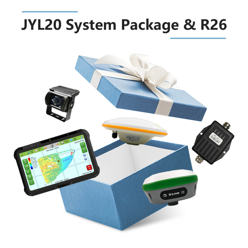
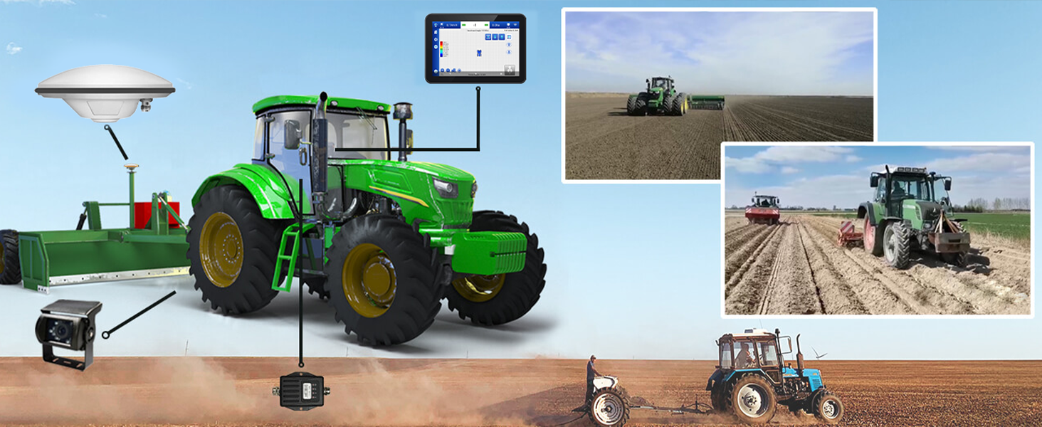
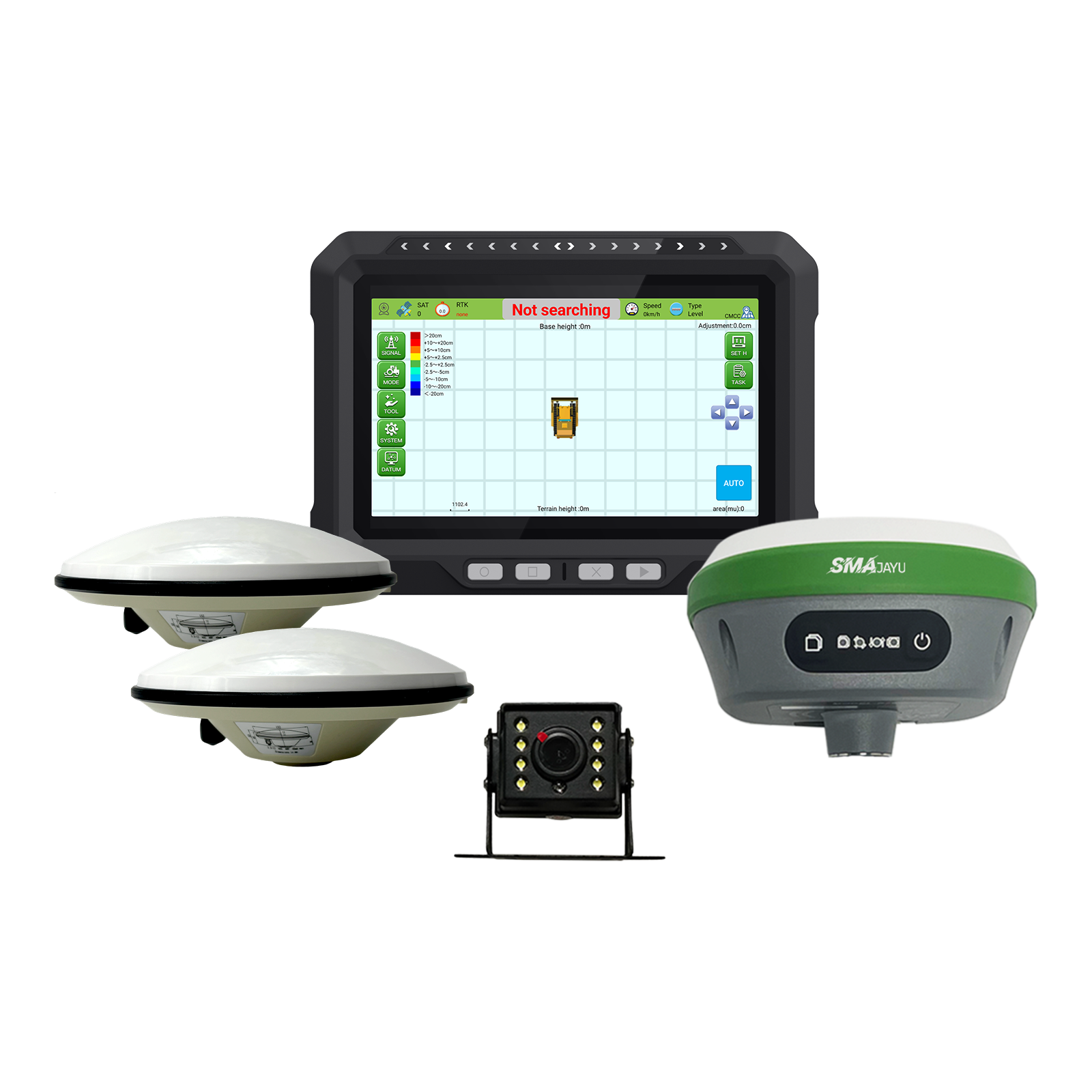
The JYL20 system includes a control table, a high precision controller, a HD camera, A10 GNSS antenna, and GNSS LAND LEVELING software.
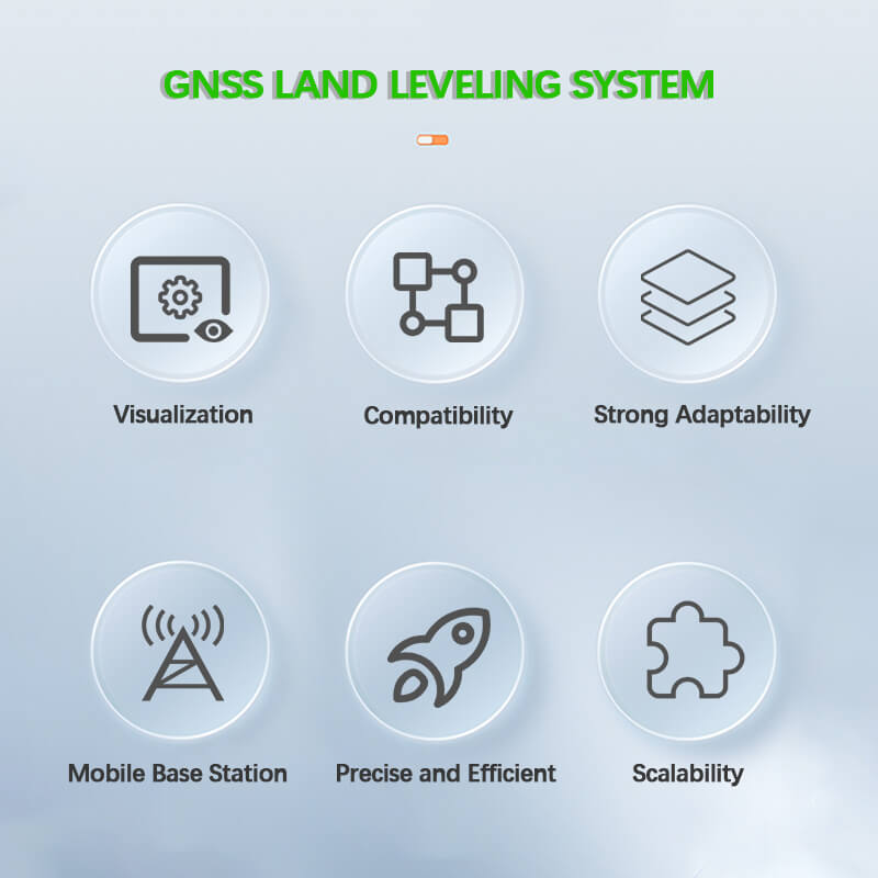
Compatibility:Match Multiple Scraper
Strong Adaptability:Sand and Dust Weather Operations
Precise and Efficient:Increase 20% working efficiency
Scalability:Scalable Auto-Steering,Guidance,Smart Sprayer
- Benefit
- Specification
- Download
- Reviews
What is a Land Leveling System
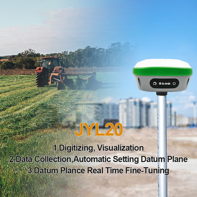
JYL20 GNSS land leveling systems is an accurate levelling system with high precision, high performance and visual operation map.
The system can seamlessly replace the laser grader, can be adapted to common leveling shovel, scraper, bulldozer, grader and other leveling machinery, realize the guidance and control of leveling machinery, leveling operation to achieve the purpose of accurate leveling, can greatly reduce the operator’s fatigue and technical requirements.
It is a sharp tool for common farmland leveling, grid field transformation, wasteland reclamation, dry land conversion and ground surface leveling.
Product Advantage
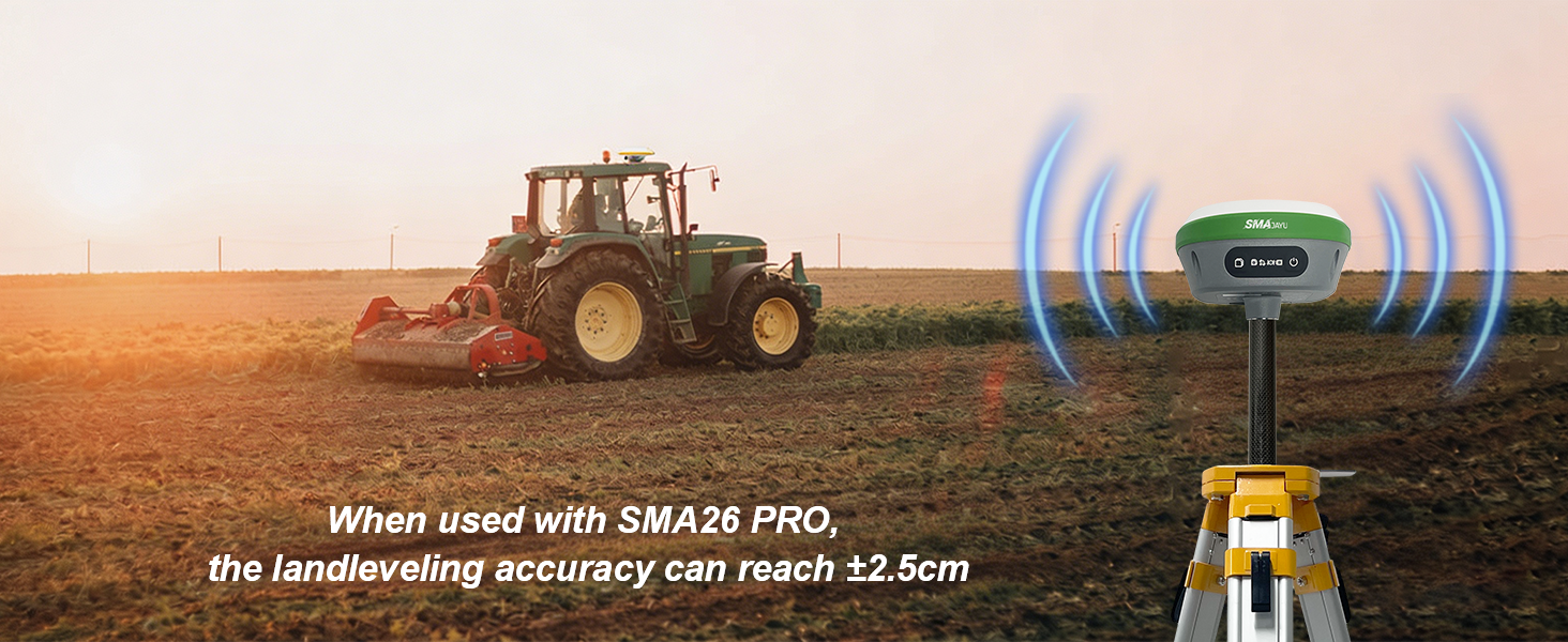
 The land leveling accuracy can reach ±2.5cm.
- Operation track, high and low terrain map, intuitive,leveling efficiency can be increased by 30%.
- There is no need to set up a base station, and the working distance is not restricted.
- The system can automatically identify the terrain and adjust the plot datum, which can improve the operation efficiency by 20%.
- Day, night, wind, dust, haze and other bad weather can work.
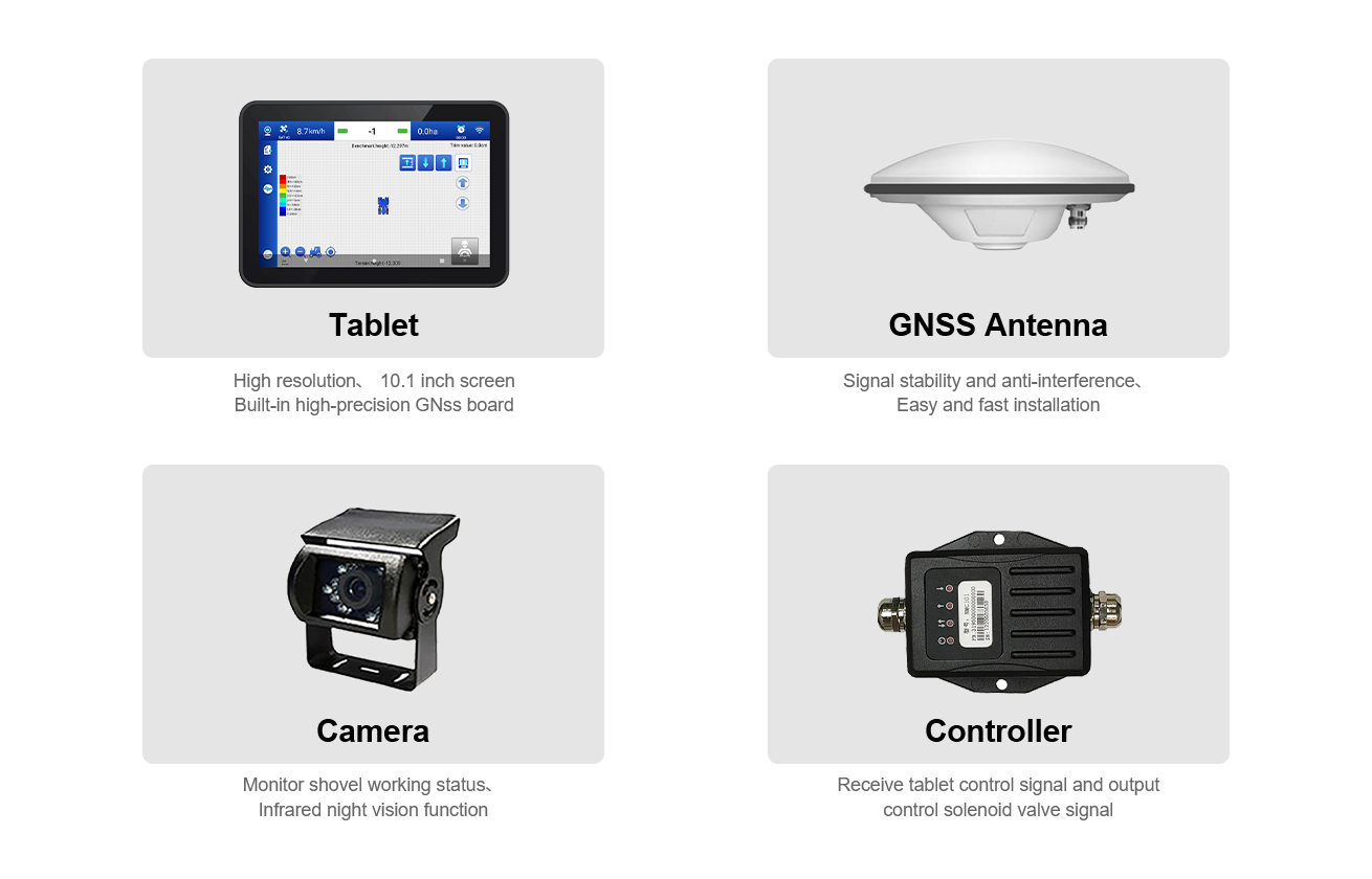
Main Accessories
Product Features
- The motor grader can be controlled through manual and automatic modes, and tablet display datum plane and height information reference datum plane in real-time.
- In the automatic mode, the field can be leveled automatically according to the height of the set datum plane, and it supports the leveling of slope and horizontal field.
- Support information upload function, system working status, working hours, working location, working area and other information can be obtained through the platform and WeChat applet.
- The terrain information is displayed in different colors, which greatly improves the work efficiency. It can understand the height and leveling of the entire field in real time. It can make accurate judgments during operation, improve work efficiency by more than 40%, and greatly save time and cost. It has a great working advantage compared with conventional laser land leveling systems and ordinary satellite leveling systems.
- The on-board terminal is compatible with our Autopilot system, intelligent spray system, driving assistance system, etc., which can greatly reduce the purchase cost of
various equipment. For specific operation items, please refer to the following detailed description.
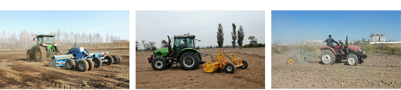
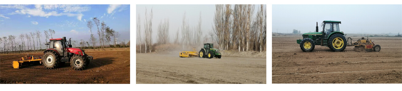
Application Field
The system can seamlessly replace the laser grader and can be adapted to ordinary leveling machinery such as levelers, scrapers, bulldozers, graders, etc., to achieve the guidance and control of the leveling machinery, so that the leveling operation can achieve the purpose of precise leveling, which can greatly reduce the fatigue and technical requirements of the operators. It is a powerful tool for leveling high-flatness ground such as ordinary farmland leveling, grid field transformation, wasteland reclamation, dry land to water, and site pavement.
Benefits after Land Leveling
- Increase Yield
Using GNSS Land Leveling System to accurately leveling the land can increaseproduction by 20-30% compared with traditional leveling technology, which is 50% of the unleveled land. These impressive results are obtained by applying the appropriate amount of water to the plants for their growth. The even distribution of water improves the environment for germination and plant growth and increases the yield of crops. - Save Irrigation Water
After the field is leveled, the water used for irrigation can be fully utilized, so that the water can be evenly distributed throughout the field, so that the uneven flow of water will not cause the irrigation water cost to increase. - Save measurement cost
There is no need to hire a survey team to measure the elevation of the land, with just a few minutes of training, anyone can accurately and quickly measure the elevation of the land after using GNSS Land Leveling System. - Reduce Fertilizer Loss
After the field is precisely leveled, not only the water can be accurately used, but the fertilizer can also be stored in the roots of the plants, which can greatly reduce the loss of fertilizer during irrigation and drainage. - Control High Location Soil
The high ground can be accurately leveled to obtain a uniform height, which reduces the erosion of the high soil by water and prevents the high soil from gathering in the low place.
JYL20 GNSS LAND LEVELING SYSTEM
JYL20 GNSS land leveling systems is an accurate levelling system with high precision, high performance and visual operation map. The system can
seamlessly replace the laser grader, can be adapted to common leveling shovel, scraper, bulldozer, grader and other leveling machinery, realize the guidance
and control of leveling machinery, leveling operation to achieve the purpose of accurate leveling, can greatly reduce the operator’s fatigue and technical requirements.
It is a sharp tool for common farmland leveling, grid field transformation, wasteland reclamation, dry land conversion and ground surface leveling.
PRODUCT DESCRIPTION
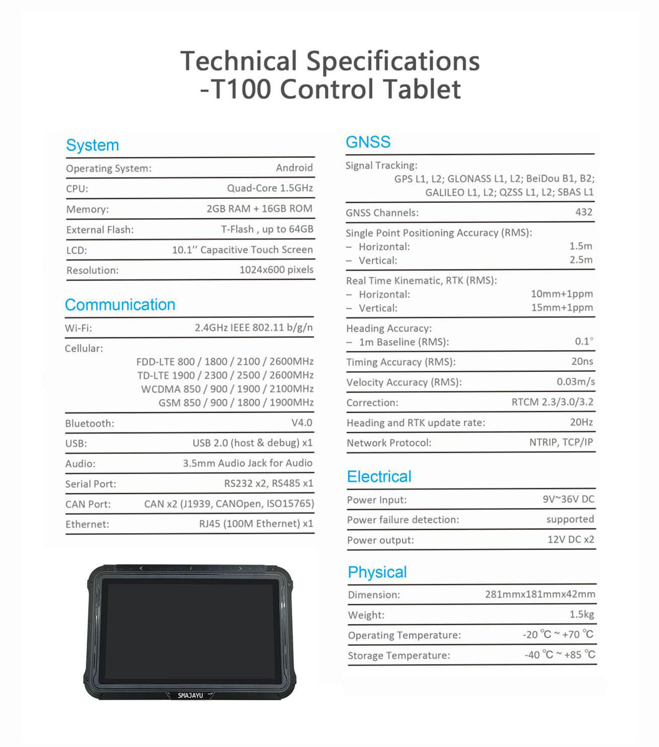
T100 Smart Tablet
Embedded with high precision GNSS module, providing ±2.5cm precision level slop leveling.
HD Camera
Visible working footprint and topographic map. Increase 30% leveling efficiency.
A10 High-Precision Positioning Antenna
Receive the satellite signal and send the satellite signal to the positioning boardFrequency Range: GPS L1/L2、BDS B1/B2/B3、GLONASS L1/L2
Match multiple scrapers.
Mobile Base Station, Simple to set up.
Scalable Auto-steering, Guidance System, Smart Spray System.
Visible working footprint and topographic map. Increasing 30% leveling efficiency.
Strong adaptability and all weather operations.
-
JYL20
1.56MB
JYL20 Tractor GNSS Land Leveling System with SMA26 PRO RTK base station
$1990
Reply to you within 24 hours
