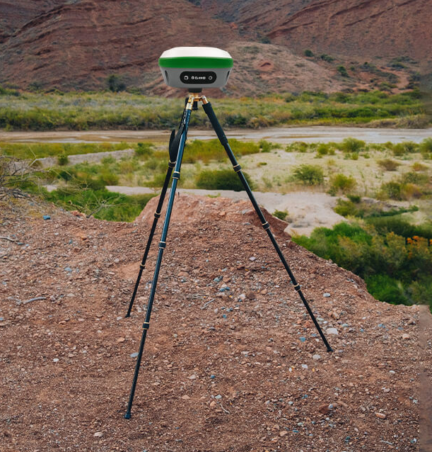
In the realm of modern surveying, accuracy is paramount. For construction, land management, cartography, or even archaeological exploration, precise location data is the cornerstone of reliable results. This is where GPS survey equipment steps in, revolutionizing how we gather geographic information. This comprehensive exploration delves into GPS survey equipment and its pivotal role in surveying applications.
Understanding GPS Survey Equipment:
Global Positioning System (GPS) survey equipment is a technological marvel that has transformed the landscape of land surveying. Utilizing a constellation of satellites orbiting the Earth, these instruments triangulate signals to determine highly accurate positions on the planet's surface. This revolutionary technology has significantly enhanced various surveying endeavors' speed, precision, and efficiency.
Components of GPS Survey Equipment
GPS survey equipment comprises several key components, each playing a vital role in ensuring accurate data collection:
- GPS Receivers
GPS receivers, the heart of the system, capture signals from satellites overhead. Modern receivers are highly sophisticated and can process multiple frequencies and signals from various satellite constellations, including GPS, GLONASS, Galileo, and Beidou.
- Antennas
Antennas are crucial for receiving satellite signals. High-quality, multi-frequency antennas are essential to mitigate signal interference and enhance accuracy, especially in challenging environments.
- Data Collectors
Data collectors serve as the interface between the surveyor and the GPS receiver. They display real-time positioning data and allow for collecting additional information, such as topographic data or notes.
- Base Stations
Base stations are employed in differential GPS (DGPS) surveys to correct errors introduced by atmospheric conditions or satellite clock drift. These reference stations transmit correction signals to the field receivers, improving accuracy.
- Software
GPS survey equipment relies on specialized software for data processing and analysis. Software packages like Trimble Business Center or Leica GeoOffice enable surveyors to create accurate maps, charts, and reports.

Applications of GPS Survey Equipment
The versatility and precision of GPS survey equipment have opened the doors to various applications across various industries.
- Construction
Accurate site mapping is crucial for project planning, resource allocation, and adherence to regulatory standards in construction projects. GPS survey equipment allows construction companies to precisely stake out building sites, monitor progress, and correctly position structures.
- Land Management
Government agencies and private landowners use the equipment for land management purposes, including boundary delineation, land title verification, and environmental monitoring. This technology aids in resolving land disputes and maintaining property records.
- Agriculture
Precision agriculture relies heavily on GPS survey equipment to optimize crop yield and minimize resource usage. Farmers use GPS-guided tractors and drones to precisely plant, fertilize, and irrigate crops, reducing waste and increasing productivity.
- Cartography
This equipment has revolutionized cartography by providing accurate geographic data for map creation. It aids in producing detailed maps for navigation, urban planning, and disaster management.
- Archaeology
Archaeologists employ GPS technology to record and map archaeological sites precisely. This enables the preservation of historical artifacts and accurate reconstruction of ancient landscapes.
- Geodesy
GPS survey equipment is indispensable in geodesy, the study of Earth's shape and size. It helps researchers measure and monitor subtle shifts in the Earth's crust, contributing to our understanding of tectonic activity and sea level changes.
Benefits of Buying From SMAJAYU
SMAJAYU is a renowned provider of GPS survey equipment known for its commitment to quality and customer satisfaction. Here are some key benefits of choosing SMAJAYU for your GPS survey equipment needs:
- Quality Assurance
SMAJAYU is renowned for its commitment to quality. The equipment offered is thoroughly tested and calibrated to ensure optimal performance. This commitment to quality translates into accurate and reliable results for your projects.
- Technical Expertise:
We employ a team of experts who are well-versed in geospatial technology. They can provide valuable guidance and technical support, helping you choose the right equipment and troubleshoot any issues that may arise.
- Wide Range of Products:
We offer a diverse selection of GPS survey equipment catering to the specific needs of different industries. Whether you require a handheld GPS device for fieldwork or a high-precision receiver for professional surveying, they have you covered.
- Customer Support
We prioritize customer satisfaction. Our responsive customer support team is ready to assist with inquiries, orders, and technical support, ensuring a smooth experience from purchase to operation.
- Warranty and Maintenance:
SMAJAYU stands behind the quality of its products with warranty options and maintenance services. This ensures that your equipment remains in optimal condition and performs reliably throughout its lifecycle.
The Future of GPS Survey Equipment
As technology advances, the future of GPS survey equipment looks promising. Here are some trends and developments to watch for:
- Enhanced Satellite Constellations
The ongoing expansion and improvement of satellite constellations, such as the GPS III system and the European Galileo program, will provide more accurate and reliable signals, further enhancing surveying accuracy.
- Integration with Other Technologies
GPS survey equipment is increasingly integrated with other technologies like LiDAR and drone technology. This integration allows for more comprehensive data collection and analysis, particularly in challenging terrain.
- Real-time Data Sharing
The ability to share real-time surveying data with remote teams and clients is becoming standard. Cloud-based platforms and mobile apps make it easier for stakeholders to access and collaborate on survey data.
- Artificial Intelligence and Machine Learning
AI and machine learning algorithms are applied to survey data to automate data processing and identify patterns and anomalies. This will save time and improve the accuracy of data analysis.
- Sustainability and Eco-friendliness
As environmental concerns grow, GPS survey equipment manufacturers are likely to continue their efforts to reduce the carbon footprint of their products and operations.
Concluding Words:
In conclusion, GPS survey equipment has revolutionized the surveying field by providing accurate and efficient data collection and analysis tools. Companies like SMAJAYU have played a pivotal role in advancing the technology and ensuring its accessibility to surveyors worldwide. As the industry evolves, the future holds even more exciting possibilities for GPS survey equipment, promising greater accuracy and efficiency in various applications.


