

Technological advancements in land surveying have continually reshaped how professionals collect accurate data about the Earth’s surface. Among these innovations, Real-Time Kinematic (RTK) Global Positioning System (GPS) technology has emerged as a game-changer. RTK GPS Topography Surveying is revolutionizing the field, offering precision, efficiency, and versatility that were previously modernized. This article will explore how RTK GPS is a modern surveying practice, from its fundamental principles to practical applications.
Importance of Modernizing Surveying Practices
The importance of modernizing surveying practices cannot be overstated. Traditional surveying methods often involved labor-intensive processes, increasing time, costs, and potential inaccuracies. In a rapidly evolving world, where precision and efficiency are paramount, adopting advanced technologies like RTK GPS Topography Surveying is crucial. This modernization allows surveyors to achieve higher accuracy, speed, and data integration, enhancing project outcomes across various applications.
The Basics of RTK GPS
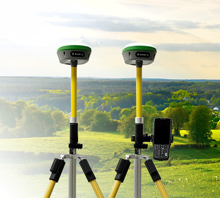
RTK GPS, short for Real-Time Kinematic Global Positioning System highly accurate satellite-based positioning technique used in surveying and mapping. Unlike conventional GPS, which provides accuracy within several meters, RTK GPS offers real-time centimeter-level accuracy. This level of precision is achieved through a combination of a base station and a rover unit.
The base station is placed at a known location, typically over a known survey control point with precise coordinates. This base station continuously receives signals from multiple GPS satellites and calculates the errors in the satellite signals caused by factors like atmospheric interference. These error corrections are then transmitted to the rover unit.
The surveyor carries the rover unit and receives signals from the same GPS satellites. However, it receives the corrected signals from the base station in real time, allowing it to calculate its precise position accurately. This real-time correction process is the essence of RTK GPS, enabling surveyors to obtain highly accurate positions quickly and efficiently.
Key Components of RTK GPS
RTK GPS systems comprise several key components:
- Base Station: The base station is the reference point with known coordinates. It continuously collects data from satellites and computes error corrections.
- Rover Unit: The rover unit is the surveyor’s handheld or surveying equipment. It receives corrected signals from the base station and calculates its position in real time.
- GNSS Satellites: The Global Navigation Satellite System (GNSS), which includes GPS and other satellite constellations like GLONASS and Galileo, provides the signals used for positioning.
- Communication Link: A communication link between the base station and the rover unit is necessary to transmit real-time corrections. This link can be established through radio waves, cellular networks, or the internet.
Advantages of RTK GPS in Topography Surveying
- Unprecedented Accuracy
One of the most significant advantages of RTK GPS in topography surveying is its unparalleled accuracy. Surveyors can achieve centimeter-level accuracy consistently, making it suitable for applications that demand precision, such as construction layout, property boundary surveys, and infrastructure development.
- Efficiency and Time Savings
Traditional surveying methods often involve manual measurements and labor-intensive processes. RTK GPS significantly reduces the time required to increase project efficiency and reducing time, leading to increased project efficiency and reduced labor costs.
- Real-Time Data Collection
RTK GPS provides real-time data, allowing surveyors to make instant decisions in the field. This capability is particularly valuable for construction site monitoring, where adjustments may be needed on the fly to ensure project alignment and quality.
- Versatility
RTK GPS is highly versatile and can be used in various terrains and environments. Whether surveying in urban areas with obstructions, forests, or remote locations, RTK GPS can deliver consistent accuracy.
Applications of RTK GPS Topography Surveying
- Land Development
RTK GPS is a valuable tool for land developers. It helps accurately map land parcels, determine property boundaries, and assess terrain conditions. Developers can make informed decisions about land use and infrastructure development.
- Construction
Construction projects rely heavily on precise measurements and alignments. RTK GPS facilitates site layout, foundation positioning, and construction progress monitoring. It minimizes errors and ensures that structures are built according to design specifications.
- Environmental Monitoring
In environmental studies, precisely measuring landscapes and natural features is crucial. RTK GPS aids in monitoring changes in terrain, water bodies, and vegetation over time. It is indispensable in conservation efforts and habitat management.
- Agriculture
Precision agriculture benefits from RTK GPS technology. Farmers can accurately map fields, plan irrigation systems, and optimize using fertilizers and pesticides. This leads to increased crop yields and more sustainable farming practices.
- Infrastructure Development
Infrastructure projects like roads, bridges, and utility installations require precise surveying to ensure safety and functionality. RTK GPS streamlines the design and construction phases, reducing costs and delays.
4 Reasons You Should Choose SMAJAYU
When adopting RTK GPS technology for topography surveying, choosing the right equipment and service provider is crucial. SMAJAYU stands out as a top choice in the industry for several compelling reasons:
- Cutting-Edge Technology
SMAJAYU is at the forefront of RTK GPS technology. Our equipment is renowned for its precision, reliability, and durability. By choosing us, surveyors can be confident they are using the latest and most advanced technology in their field.
- Comprehensive Solutions
We offer a comprehensive suite of solutions for topography surveying. From high-precision GPS receivers to data processing software, we provide everything a surveyor needs to streamline their operations and achieve accurate results.
- Proven Track Record
SMAJAYU has a proven track record of success in the industry. We have served clients in various sectors, from construction companies to government agencies. Our reputation for delivering reliable and accurate solutions speaks for itself.
- Innovation and Adaptability
In the fast-evolving field of surveying technology, innovation and adaptability are key. We continually invest in research and development to stay ahead of the curve. We are committed to providing surveyors with the tools we need to excel in their work today and in the future.
Conclusion
RTK GPS Topography Surveying has revolutionized the field of land surveying, offering unprecedented accuracy, efficiency, and versatility. This technology has applications in land development, construction, environmental monitoring, agriculture, and infrastructure development. While there are challenges to consider, the benefits of RTK GPS make it a vital tool for modernizing surveying practices. As technology evolves, RTK GPS will likely play an even more significant role in shaping the future of surveying and mapping. Its ability to provide real-time, centimeter-level accuracy has undoubtedly changed the industry’s landscape, paving the way for more efficient and precise land management and development.
