

What is the track GNSS agriculture guidance system?
With a track GNSS (Global Navigation Satellite System) navigation system for agriculture, farmers may more precisely navigate and control their agricultural gear in the field. A device with a GNSS receiver may use a GNSS system to pinpoint its exact location, speed, and direction via satellite signals. Farmers may boost the precision and effectiveness of their field operations with the track GNSS guiding system, which has advantages such as less input wastage, optimized fuel usage, fewer overlaps, higher crop yield, and better farm output. A track GNSS guiding system in the context of agriculture often includes the following elements:
What Are the Economic Advantages of a GNSS Guidance System for Farming Operations?
A GNSS (Global Navigation Satellite System) guiding system’s precise positioning and navigational capabilities may significantly improve farming operations. Optimizing farmer productivity, cutting expenses on inputs, and raising farm revenue are SMAJAYU intelligent agriculture’s key objectives, protecting farmland and fostering a healthy agricultural environment. To help with the agriculture industry’s increasing expansion, SMAJAYU is searching for dealership opportunities for auto-steering precision systems in agricultural nations and areas. Here are a few benefits of a GNSS guiding system for farming:
- Precision farming:
Precision farming is made possible by GNSS, which determines the location of farming machines and equipment in the field. This minimizes waste and maximizes resource use by enabling accurate and targeted application of fertilizers, insecticides, and herbicides. Precision farming may increase agricultural yields, save expenses, and have a minimal negative environmental impact.
- Automated guiding:
Tractors and harvesters, among other agricultural vehicles, can have their steering and navigation automated using a track GNSS guiding system. Farmers may program particular pathways for their equipment to follow using precision GNSS receivers and sophisticated guiding software, assuring accurate and repeatable operations. This makes farming activities possible around the clock and lessens operator weariness.
- Section Control and Variable Rate Application:
Section Control and Variable Rate Application are made possible by integrating GNSS guiding systems with tools and machinery. Section control enables farmers to automatically turn on and off certain equipment (such as seeders or sprayers) depending on predefined zones or limits to avoid application overlap or skips. Input amounts (such as seed, fertilizer, or irrigation) are adjusted based on particular fields, considering the soil’s variability or the crop’s needs. Input expenses are decreased while productivity is increased because of this optimization.
- Map-making and data management:
By integrating GNSS receivers with additional sensors (such as yield monitors, soil moisture sensors, or weed detection systems), it is possible to produce in-depth maps of field features and crop performance. These maps offer useful data for decision-making, such as yield mapping, identifying soil variability, or analyzing weed distribution. Farmers can optimize future actions and raise overall production by gathering and analyzing data from various farming operations.
- Time and Cost Savings:
Farmers may save time and money due to GNSS guiding systems’ automation and precision. Precision positioning and guiding reduce overlapping passes, saving time, fuel, and inputs. Farmers may concentrate on higher-value activities as labor requirements are reduced by automating monotonous operations. Furthermore, properly tracing field inputs and activities makes record-keeping, compliance reporting, and audits easier.
- Integration with Farm Management Systems:
GNSS navigation systems can communicate seamlessly with platforms and software for farm management. This enables real-time monitoring. This connection improves decision support capabilities by delivering up-to-date information on equipment status, field conditions, and productivity measures. Additionally, it permits remote monitoring and management, enabling farmers to manage activities and react swiftly to changing circumstances efficiently.
GNSS Guidance Systems for Agricultural Machinery: Accuracy and Reliability:
GNSS (Global Navigation Satellite System) navigation systems have gained popularity in the agricultural business for directing and automating numerous duties carried out by agricultural machinery. These systems employ satellite signals to pinpoint the position and motion of the equipment precisely. While GNSS guiding systems have several advantages, including increased precision and dependability for agricultural applications, increased efficiency, and less operator fatigue.
- GNSS guiding systems provide agricultural machines with precise positional data. The kind of GNSS receiver used, the quantity and quality of satellite signals received, and any signal interference are some variables that affect accuracy. Modern GNSS systems may often attain sub-meter to centimeter-level precision, depending on the precise tools and correction techniques used.
- For agricultural applications, GNSS guiding systems have typically shown to be dependable. They are made to survive extreme conditions like dust, wetness, and vibrations frequently seen in the field. However, it’s crucial to consider various difficulties that can impair dependability, such as signal blocking in heavily forested regions, signal multipath caused by reflections from surrounding structures, or momentary loss of satellite signals during severe weather.
The Different Types of Track GNSS Guidance Systems:
All farmers must use a track GNSS guidance system to increase yields and run operations more effectively. The method enables farmers to monitor their progress, get a birds-eye perspective of their fields, and make more informed decisions. Various agricultural guiding systems come in a variety of varieties nowadays. Each system has special powers and qualities that make it stand out. The system you choose must meet your requirements. The typical varieties include optical guiding systems, GPS, GNSS RTK, and antennae.
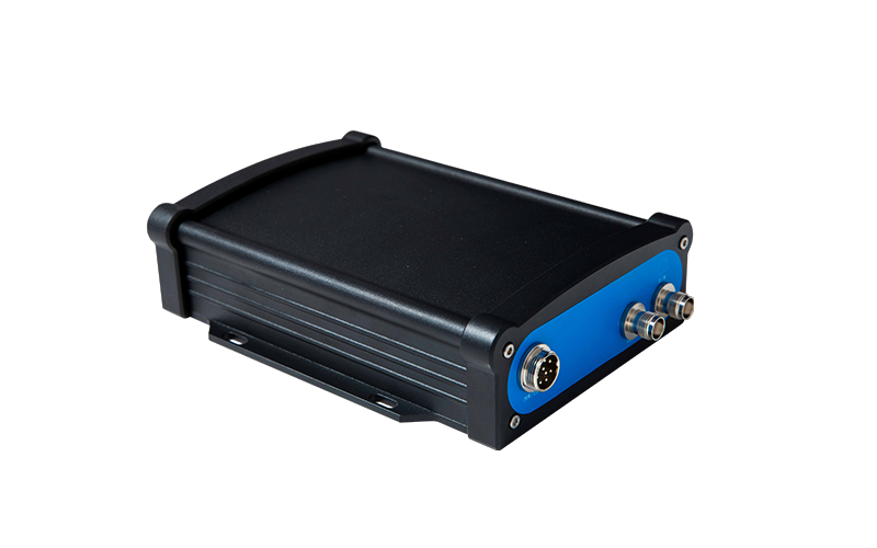
GNSS RTK: This is a component mounted on agricultural equipment, including tractors, sprayers, and harvesters, that receives signals from various GNSS satellites like GPS. The receiver determines the vehicle’s precise location.
Antenna: it provides the best possible reception of satellite signals; the GNSS antenna is often positioned on the top of the agricultural vehicle.
Conclusion:
The tract GNSS guidance system provides the most exact and precise guidance currently available, which is created especially for precision farming. Global Navigation Satellite System is referred to as GNSS. When it comes to precision agriculture is a terrific tool for farmers since it allows you to pinpoint your location precisely and become oriented in a certain region. Global dealers for SMAJAYU precision agricultural technology are actively being developed. The method for providing after-sales support is excellent, with timely responses and high levels of efficiency.
