

Surveying is a crucial discipline that underpins various industries, ensuring accurate measurements for construction, land development, and more. The precision of surveying directly impacts project success and safety. Enter SMAJAYU, a distinguished surveying tools provider with a legacy dating back to 2009. With over a decade of experience, SMAJAYU has witnessed the transformation of surveying technology, evolving from traditional devices to cutting-edge surveying tools. By integrating GPS accuracy technology, SMAJAYU’s agricultural guidance and auto-steer systems enable centimeter-level precision farming, ushering in a new era of efficiency and productivity in agriculture.
Fundamentals of Surveying
Definition and Objectives of Surveying
Surveying, regarded as both an art and a science, involves the precise measurement and mapping of the Earth’s surface. Its core objectives encompass determining the relative positions of points on the Earth’s surface, establishing boundaries, and crafting detailed representations of landscapes. Surveying assumes a pivotal role across various sectors, including civil engineering, construction, environmental planning, and land development.
Types of Surveys
A diverse array of surveys exists, each tailored to specific purposes. Land surveys are dedicated to delineating property boundaries and land divisions. Construction surveys hold essential significance in guaranteeing the accurate layout and alignment of structures during construction endeavors. Meanwhile, geodetic surveys encompass extensive measurements of the Earth’s shape and size, often in the context of applications such as satellite positioning systems.
Importance of Precision in Surveying
Precision in measurements serves as the bedrock of surveying. It facilitates informed decision-making and ensures the success and safety of projects. Errors and inaccuracies in surveying can result in costly consequences, including legal disputes over property boundaries and compromised infrastructure integrity. Surveyors employ advanced instruments and techniques to attain the pinnacle of accuracy, upholding the highest standards of precision in their professional work.
SMAJAYU Surveying Tools
Introduction to SMAJAYU’s Product Range
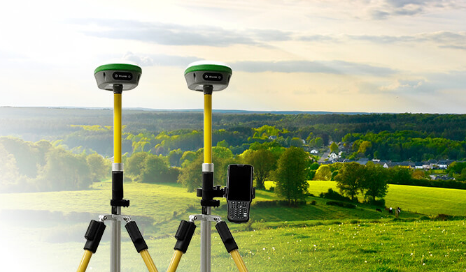
SMAJAYU offers a comprehensive product range designed to revolutionize surveying. The flagship product, the R26 Surveying System Rover+Base, stands out with its exceptional capabilities:
- Global GNSS Corrections: The receiver can access SMAJAYU’s cutting-edge GNSS global corrections service through both satellite and internet, enabling centimeter-level positioning accuracy.
- Multi-Satellite Support: The system excels in full-band satellite signal reception, ensuring robust performance across diverse satellite systems.
- Higher Accuracy and Precision: Engineered for rigorous field use, the R26 system is built to deliver unmatched precision.
Key Features and Benefits of SMAJAYU Tools
The R26 integrated Beidou/GNSS receiver is a remarkable technological feat, boasting:
- Large-Capacity Battery and Memory: Equipped with a built-in high-capacity battery and memory card for extended operation and data storage.
- Multi-Functionality: It incorporates various high-precision components, including inertial navigation, RTK receiver, Beidou/GNSS full-frequency antenna, and multiple frequency points for precise positioning and orientation.
- Exceptional Performance: The R26 survey system achieves centimeter-level precision within seconds and maintains reliable fixed RTK accuracy even in challenging environments.
- Enhanced Satellite Tracking: With its high-gain antenna, the system boosts GNSS satellite signal tracking efficiency by up to 50%, ensuring survey-grade positioning accuracy across GPS, Glonass, BeiDou, Galileo, and QZSS constellations.
How SMAJAYU Tools Contribute to Precision and Efficiency in Surveying
SMAJAYU survey tools are engineered to elevate precision and efficiency in surveying practices. They empower surveyors to:
- Attain Centimeter-Level Precision: SMAJAYU’s cutting-edge technology ensures that surveyors can achieve centimeter-level precision in their measurements, crucial for accurate and reliable data.
- Streamline Field Operations: The integrated design and advanced features of SMAJAYU tools streamline fieldwork, reducing time and effort required for data collection and processing.
- Overcome Challenging Environments: SMAJAYU tools are built to excel in challenging conditions, ensuring reliable performance in diverse surveying scenarios.
- Boost Productivity: By increasing the efficiency of data collection and surveying tasks, SMAJAYU tools contribute to enhanced productivity in the field, ultimately leading to cost savings and improved project outcomes.
Precision Techniques
Importance of Precision in Surveying
Precision is the cornerstone of successful surveying. It ensures that measurements are accurate, consistent, and reliable. In surveying, even the smallest error can have significant consequences, leading to costly mistakes, legal disputes, or compromised project quality. Precision is essential for achieving the project’s objectives, whether it involves land boundary delineation, construction layout, or geodetic measurements.
How to Achieve Precision with SMAJAYU Tools
SMAJAYU tools are designed with precision in mind, and they offer several features and techniques to enhance the accuracy of surveying:
- High-Precision GNSS: SMAJAYU’s GNSS technology provides centimeter-level accuracy, ensuring precise positioning and data collection.
- Advanced Antenna Design: The tools incorporate high-gain antennas to optimize satellite signal reception, even in challenging environments.
- Data Post-Processing: SMAJAYU equipment allows for the post-processing of data to further enhance precision.
- Calibration and Maintenance: Regular calibration and maintenance of tools are crucial to ensuring continued precision in surveying operations.
Case Studies Demonstrating the Impact of Precision on Surveying Results
Real-world examples and case studies showcase how precision in surveying can lead to successful outcomes. These cases illustrate instances where SMAJAYU tools have played a pivotal role in achieving accurate results, highlighting the importance of precision in surveying projects of all scales.
Efficiency Strategies
Increasing Efficiency in Surveying Workflows
Efficiency is a key factor in surveying, as it directly impacts project timelines and resource utilization. SMAJAYU tools offer strategies to enhance efficiency:
- Streamlined Workflows: SMAJAYU equipment is designed for user-friendly operation, reducing the time needed to collect data and perform surveys.
- Data Integration: Seamless data integration capabilities allow for efficient data transfer and analysis.
- Automation: SMAJAYU’s automation features, such as auto-steer and guidance systems, reduce the need for manual intervention, saving time and effort.
Leveraging SMAJAYU Tools for Time and Resource Savings
SMAJAYU tools are engineered to optimize resource utilization and reduce surveying timeframes:
- Reduced Field Time: High-precision GNSS technology and efficient data collection methods minimize the time required for fieldwork.
- Cost Savings: Efficient workflows translate to cost savings, making surveying projects more economically viable.
- Resource Allocation: SMAJAYU tools help surveyors allocate resources more effectively by providing accurate data and insights.
Take the Leap: Elevate Your Surveying with SMAJAYU Tools!
Mastering surveying with SMAJAYU tools offers a pathway to precision and efficiency in the field of surveying. With cutting-edge technology, centimeter-level accuracy, and streamlined workflows, SMAJAYU empowers professionals to achieve reliable results while saving time and resources. As the industry evolves, SMAJAYU’s commitment to innovation ensures its tools remain at the forefront of surveying practices. Embracing these tools not only elevates surveying capabilities today but also prepares surveyors for the challenges and opportunities of tomorrow.
