

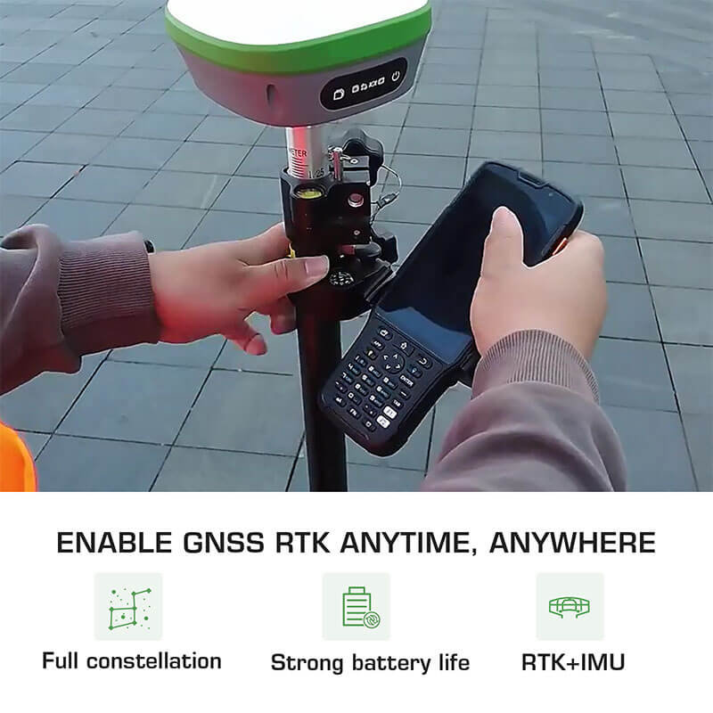
The use of RTK survey GPS equipment represents the leading edge of innovation in the surveying industry. This device makes use of a real-time kinematic (RTK) GPS, which enables it to pinpoint measurement and reference locations in a timely and accurate manner. RTK GPS survey equipment, such as SMAJAYU, does not need processing after the survey has been finished. It allows for instant response to be provided in the field, giving data on accuracy and quality testing without the need to analyze the survey or return to the area for a do-over. This kind of surveying is advantageous for surveyors since it may be used for both level 3 and level 4 surveys at the same time.
How does RTK survey GPS work?
- Real-time surveys conduct using RTK GPS survey equipment with either a single or dual frequency, but the L1 carrier phase is always employed to bring the survey to its successful conclusion. Due to the frequency capabilities, this indicates that RTK surveys can only be undertaken within a radius of around 10 kilometres (km) from the base.
- On the other hand, there are occasions when the whole range is employed for the survey, which necessitates shorter distances in order to keep the accuracy level at 2 centimetres. Utilizing a GPS system is both time and labour-saving, but there is no guarantee that the outcomes will match your expectations.
- When doing a survey using RTK GPS technology, a surveyor is limited in what they can accomplish according to the number and location of satellites that are accessible on that particular day. The need to rearrange your calendar to accommodate the satellites may seem to be an additional strain, yet, doing so will really result in an increase in both your productivity and effectiveness.
Advantages:
The majority of GPS-based software packages are equipped with a component that predicts satellite coverage, which helps surveyors plan and organize their activities. Because of the way that these instruments were developed to make the most of the technologies that are available today, the process of surveying is now far more efficient, accurate, and reliable than in the past.
Although not all surveyors have access to RTK GPS survey technology, contractors and landowners who work with surveyors who do have this capability may reap the benefits of doing so. It increases the trustworthiness of the survey, lowers the possibility that there will be problems, and gives the entire affair an air that is more serious and assured. If more modern technology is used in the survey, it will be to everyone’s benefit, whether it be the surveyor, the landowner, or the governing body. Anyone who requires the services of a professional land or building survey should make it a priority to educate themselves about RTK GPS technology and the advantages it may bring to the surveying process.
What You Should Watch Out For When Buying RTK GPS Survey Equipment?
It is helpful to have some notion of what you are looking for before going out into the market. There are a few things you should keep in mind if you want to get the most out of the RTK survey GPS equipment you acquire so that you may maximize its potential. Here are a few illustrations:
Make sure you find out the name of the manufacturer and the model number of the piece of equipment you wish to buy:
Acquire the ability to identify the piece of equipment by its brand name. It is imperative since it will determine the overall quality of the product as well as whether or not it will be beneficial to you in the long run. It is a good idea to check reviews of various models and brands online before making a purchase so that you can have a better idea of what you’re getting. When looking for this sort of equipment, purchasing online often gives a wider variety, which makes it simpler to pick a dependable product. Visit a store that provides demonstrations if you want to acquire a better understanding of how the pieces of equipment you’re thinking about purchasing work in practice.
Before moving on, you should create a budget:
Set a budget for yourself. Some people may be able to afford to spend a lot, while others may be forced to choose cost-effectiveness over more bells and whistles.
Shop around:
Suppose you are buying RTK survey GPS surveying equipment for yourself or a small organization. In that case, it is possible to get it by spending less money on a more basic model if there is a choice to be made between many different models or options.
But before making a decision, it’s a good idea to shop around. You should familiarise yourself entirely with the item by reading its description in its entirety before making a purchase. Assess the goals that you have set for the mapping and surveying GPS equipment.
Think about what you need from the GPS surveying tool:
If all you’re doing is conducting some simple mapping, you don’t need a complicated and challenging tool to achieve it.
However, suppose you want to utilize the device for more specialized objectives, such as discovering particular buildings or identifying specific routes. In that case, you should think about what to expect when acquiring a used model.
Perform a thorough inspection of the whole equipment.
Check the software package included, if any:
How extensively do you intend to make use of the GPS capabilities? Do you also plan to use it for traveling in addition to participating in other kinds of outdoor activities? Do you intend to make use of any of the other applications that was along with the system?
Regardless of whether or not this is the case, you will need to decide whether or not investing your money will be worthwhile. Purchasing the required software would be a simpler and more cost-effective alternative to purchasing specialized GPS hardware.
Determine if the product’s warranty is still in effect and for how long it will remain in effect:
Why do you seek the manufacturer to solve your problem? Products that are considered to be of higher quality are often constructed to be resistant to adverse situations. There is a good chance that they will also offer functions that, after you have gained some familiarity with them, are simple to use.
SMAJAYU offers two years of warranty! Investigate the information included in the warranty to determine whether or not it is still current and for how long the product is covered. After reading this, you should have a lot better idea of what to expect from the purchase of a used item.
Conclusion:
Real-Time Kinematic, or RTK, surveying utilizing Global Navigation Satellite Systems is often used in surveying. In this guide, we have provided surveyors easy to follow guidelines. Now it’s time to shop for your favourite RTK GPS system from SMAJAYU. It is literally a game-changer!
