

Real-Time Kinematic Global Navigation Satellite System (RTK-GNSS) is a technique used for enhancing the accuracy of GNSS positioning. RTK-GNSS receivers are capable of providing centimeter-level accuracy over a wide area. It is an integrated, low-cost, and highly precise positioning system, based on the combination of GNSS signals and inertial motion unit (IMU) technology. This article provides an overview of IMU RTK GNSS RECEIVER and its applications.
Overview: IMU RTK GNSS RECEIVER
IMU RTK GNSS receivers are a type of advanced navigation system that combines inertial measurement unit (IMU) and relative kinematic (RTK) global navigation satellite system (GNSS) technologies to provide highly accurate position information. By combining the two technologies, users can enjoy increased accuracy, reduced latency, and improved reliability.
Exploring the Components of an IMU RTK GNSS Receiver
The IMU RTK GNSS receiver system is composed of several components, including a GPS receiver, IMU, base station, and software. Each component plays an important role in providing accurate position, velocity, and orientation data for navigation and mapping applications. They combine precise GNSS positioning data with inertial measurements from an Inertial Measurement Unit (IMU) to provide more precise and reliable positioning solutions.
- GNSS Receiver
A GNSS receiver is a device used to locate and track an object using global navigation satellite systems. GNSS receivers are used in a variety of applications, including navigation, surveying, timing, and positioning.
- IMU
Inertial Measurement Units (IMUs) are devices used to measure and track the orientation of a body in space. IMUs are commonly used in robotics, aerospace, and navigation applications, due to their ability to accurately measure orientation, velocity, and acceleration.
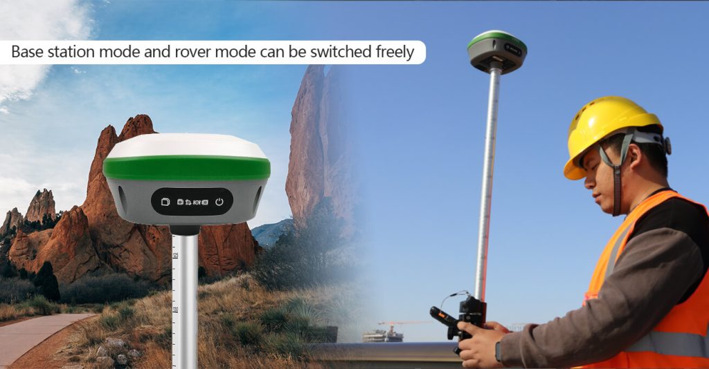
- RTK base station
A real-time kinematic (RTK) base station is a type of GNSS receiver used to precisely determine the location of a surveyor or other person in the field. This technology is often used in surveying, agriculture, and other industries that require precise positioning.
Applications of IMU RTK GNSS RECEIVER
IMU RTK GNSS receivers are a powerful tool for a wide range of industries and applications. From aerospace and automation to agriculture and navigation, GNSS receivers are used to improve accuracy and provide critical data.
- Precision agriculture
Precision agriculture is a growing trend in the agricultural industry. By utilizing an IMU RTK GNSS Receiver, farmers can gain a highly accurate, real-time view of their fields and crop health. This technology has the potential to revolutionize the way farmers monitor and manage their crops, resulting in greater efficiency and higher yields. The receivers can utilize inertial measurement units (IMUs) to measure the orientation of the receiver, allowing for more accurate positioning and navigation.
- Surveying
RTK GNSS receivers are becoming increasingly popular tools for surveyors, as they provide more accurate and reliable results than traditional surveying methods. RTK GNSS receivers offer many advantages, including faster setup and data collection times, improved accuracy, and better coverage in difficult environments.
- Automotive navigation
Real-Time Kinematic (RTK) GNSS receivers are revolutionizing how vehicles are navigated. The use of GNSS in our daily lives is growing exponentially, from simple navigation of our daily commute to vehicles to more complex and accurate applications such as autonomous vehicle navigation. RTK GNSS receivers are more accurate than traditional GNSS receivers, providing centimeter-level accuracy. This increased accuracy is beneficial for automated driving, as it allows vehicles to accurately identify their location and surroundings.
- Robotics
RTK GNSS receivers can be used for various robotics applications including navigation and localization, obstacle avoidance, and trajectory planning. The use of a high-precision GNSS receiver for robotics applications has been a topic of considerable interest among researchers. Such a receiver is capable of providing real-time kinematic (RTK) positioning of a robot, in which the receiver can determine its position with high accuracy and in real time.
Advantages of GNSS RECEIVER
GNSS receivers are a valuable tool for any business or individual that needs reliable and accurate location data. They are versatile, easy to use, and can be used for many different applications, from navigation to surveying. In addition, GNSS receivers can provide a variety of benefits, including improved accuracy, better data collection, and reduced costs.
- Location accuracy
A GNSS receiver is a device that uses Global Navigation Satellite System (GNSS) to determine its exact location with precision. With the help of satellites in orbit, a GNSS receiver can provide accurate location data for applications such as mapping, navigation, surveying, and other geospatial tasks.
- Versatility
GNSS receivers are incredibly versatile, providing a range of features and capabilities that make them ideal for use in a variety of applications. They are available in both handheld and fixed-mount models and can be used for accurate and reliable positioning, navigation, and timing services.
- Improved safety
GNSS receivers improve safety by providing accurate, real-time location data and helping users orient themselves within their environment. GNSS receivers can be used for navigation, surveying, tracking, and mapping, and are especially useful for emergency response and search and rescue operations.
SMAJAYU GNSS Receiver: Everything You Need to Know
SMAJAYU GNSS Receiver is a high-performance solution for the needs of professionals in the field of geospatial data collection and positioning. It is designed to be used in a variety of applications, from surveying and mapping to unmanned aerial vehicle (UAV) navigation. It is a powerful and versatile solution that provides reliable and accurate positioning data for a variety of applications. It is easy to use and offers a range of features that make it an ideal choice for professional and recreational users alike.
Bottom line
The SMAJAYU IMU RTK GNSS receiver is a powerful and versatile tool for surveying, mapping, and navigation applications. It offers high accuracy, reliability, and affordability, with features such as RTK-GNSS corrections and integrated IMU, making it an ideal choice for a wide range of projects. It provides users with a high-precision solution for surveying, navigation, and positioning applications in rugged and challenging environments.
