

What does GPS surveying equipment mean?
- The tools and equipment used in surveying and mapping applications using the Global Positioning System (GPS) are called GPS survey equipment. Accurate location and timing data are available anywhere on Earth thanks to the satellite-based navigation system known as GPS. Antennas, different attachments, and a receiver unit are the usual components of survey equipment. The receiver unit estimates the user’s position, velocity, and time based on the time it takes for the signals to reach the receiver. It gets signals from numerous GPS satellites.
- The satellite signals are received using antennas, which may be installed on tripods or other surveying equipment. Land surveying, building, engineering, geodesy, and mapping are just a few uses for GPS survey equipment. It enables surveyors and experts to precisely pinpoint the coordinates and elevations of places on the surface of the Earth, producing maps, calculating distances, and drawing borders. Data logging, real-time kinematic (RTK) capability for centimeter-level precision, and interaction with other surveying instruments are a few more characteristics the equipment could have.
The worth of GPS survey equipment:
As new technology changes how farmers cultivate their land, the use of GPS in agriculture has grown increasingly significant. A “GPS” is a “global positioning system,” a piece of technology that helps farmers pinpoint the exact location of their animals, equipment, and crops. This technology helps farmers run their farms more efficiently and productively. It frequently consists of specialized equipment and techniques that precisely locate locations using GPS (Global Positioning System). Using the equipment, surveyors may gather information on the points, distances, elevations, and other measures required for mapping, building, land surveying, and various engineering applications.
- Agriculture depends heavily on GPS, which is used for everything from surveying and mapping to yield analysis and machine guidance.
- Using GPS, farmers can map their land more precisely, plant their crops, and track their growth.
- Additionally, GPS helps farmers to reduce costs and increase profits.
- Farmers may use GPS survey technology to establish the location of their crops, the yield, and the best ways to care for them.
- To maximize their inputs and increase yield, farmers utilize GPS.
- Technology has altered agriculture, making it more precise and profitable.
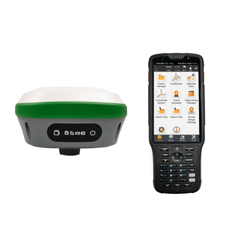
Rover 26 is surveying equipment that has the following features:
- The R26 integrated Beidou/GNSS receiver comprises large-capacity batteries, large-capacity memory cards, and an integrated multi-functional high-precision device.
- Autonomous development of SMAJAYU’s integrated Beidou/GNSS full-frequency antenna, multiple frequencies, and inertial navigation RTK receiver. Regions of the system, high-precision location, orientation boards, radio, Bluetooth, and inertial navigation.
How effective is GPS RTK surveying equipment?
RTK GPS survey equipment uses real-time surveys using a single or dual frequency; however, the L1 carrier phase is always employed to guarantee the survey’s success. This means that RTK surveys can only be carried out within a radius of around 10 kilometers (km) from the base due to the frequency capabilities. On the other hand, when doing the survey throughout the entire range necessitates travelling shorter distances to keep the accuracy level at 2 centimeters. Although a GPS can reduce work and time requirements, there is no guarantee that the outcomes will satisfy your expectations. The amount of work, a surveyor, can complete with RTK GPS technology depends on how many and where the satellites are on any given day. Even though you may have to rearrange your schedule to make place for the satellites, doing so will increase your output and effectiveness.
Advancing Measuring using GPS Survey Equipment:
By offering accurate and effective measuring capabilities, GPS survey technology has revolutionized the area of land surveying. Modern GPS survey tools have raised the bar for measurement thanks to technological breakthroughs. Following are some of the main characteristics and advantages of GPS survey equipment:
High-precision positioning: To establish exact coordinates, survey equipment uses satellite-based positioning systems. This makes it possible for surveyors to measure objects with centimeter-level accuracy, producing data that can be trusted.
- Quick data gathering:
GPS survey technology enables surveyors to gather data across huge regions fast. Surveyors can acquire precise measurements with little setup time or physical markers by employing real-time kinematic (RTK) or post-processing approaches.
- Productivity gains:
Setting up surveying equipment and measuring points manually took a lot of time and effort when using traditional surveying techniques. By streamlining the process, GPS survey technology increases productivity and shortens project timeframes by enabling surveyors to cover more land in less time.
- Greater safety:
GPS survey equipment reduces the time surveyors must spend working in dangerous or difficult conditions. It improves safety on surveying projects by providing remote data gathering and decreasing the requirement for human access to challenging terrain or dangerous regions.
- Real-time data visualization:
Modern GPS survey tools frequently come with cutting-edge display panels that offer this service. Surveyors may evaluate the measurements that have been taken and decide on the spot based on the information, enabling quick quality checks and, if necessary, revisions to surveying procedures
- Wireless communication and data transfer:
It is frequently integrated with wireless communication capabilities, allowing surveyors to submit data to a central database or work in real-time collaboration with peers. No matter where the survey teams are physically located, this capability enables effective data exchange and cooperation.
Conclusion:
It employs a base station and rover with the Global Positioning System (GPS) to attain centimeter-level precision. When SMAJAYU was constructed in 2009, technology had already undergone a ten-year transition from traditional to cutting-edge equipment. Precision farming to a centimeter is guaranteed when using SMAJAYU GPS survey equipment paired with GPS accuracy technology. It is used to map the landscape, monitor building sites, and track assets by precisely measuring the locations of items. We can now achieve our new objective of encouraging agricultural growth thanks to intelligent agriculture. The highly accurate and reasonably priced RTK GNSS system encourages agricultural technology deployment on farms of all sizes.
