

Precision agriculture has transformed the way farmers approach cultivation and resource management. In this era of advanced technologies, GPS Land Levelling systems have emerged as a game-changer for precision agriculture. These systems offer accurate positioning and real-time data analysis, enabling farmers to optimize their land’s topography, water distribution, and overall productivity. This blog delves into the various aspects of GPS Land Levelling systems and explores how they enhance efficiency, yield, and profitability in modern farming operations.
Understanding GPS Land Levelling Systems:
1. How GPS Land Levelling Works:
GPS Land Levelling systems utilize satellite technology to precisely measure and map the topography of agricultural land. Equipped with Global Positioning System (GPS) receivers, these systems accurately determine the location of the farming equipment and collect data on the terrain’s elevation and slope. By integrating this data with sophisticated software, farmers can precisely calculate the earthwork required for levelling and develop customized land-levelling plans.
2. Benefits of GPS Land Levelling:
a) Improved Field Topography:
By eliminating irregularities in field topography, GPS Land Levelling systems create a more uniform surface for crop cultivation. This reduces the risk of waterlogging and ensures uniform water distribution, resulting in enhanced crop growth and reduced water wastage.
b) Enhanced Water Management:
Accurate land levelling facilitated by GPS systems improves water management by ensuring uniform irrigation. By eliminating low spots and creating even fields, farmers can optimize water distribution, reduce runoff, and minimize the need for additional irrigation resources.
c) Increased Yield and Productivity:
Uniform land surfaces allow crops to receive consistent levels of water, nutrients, and sunlight, promoting healthier growth and increased yields. GPS Land Levelling systems enable precise land preparation, facilitating the efficient use of resources and reducing input costs.
Utilizing GPS Land Levelling for Precision Agriculture:
1. Site Analysis and Planning:
Before implementing GPS Land Levelling, farmers must conduct a thorough analysis of their fields to assess the topography, identify drainage issues, and plan suitable land-levelling strategies. By leveraging GPS technology, farmers can create accurate topographic maps, which serve as a foundation for precise planning and decision-making.
2. Implementing Land Levelling Operations:
During land levelling operations, GPS Land Levelling systems guide the farm machinery with utmost precision. The GPS receivers integrated into the equipment transmit real-time location data to the software, allowing operators to monitor and adjust the levelling process in response to the field’s topographic variations. This ensures that the land is levelled uniformly and according to the predetermined plan.
3. Post-Operation Evaluation:
After levelling the land, GPS systems aid in post-operation evaluation by comparing the achieved topography with the desired results. Farmers can analyze the accuracy of the levelling process and identify any deviations from the original plan. This information is valuable for future decision-making and improvement of land management practices.
Why Choose SMAJAYU As Your GPS Land Levelling System Supplier?
1. Quality Products for Precise Land Levelling
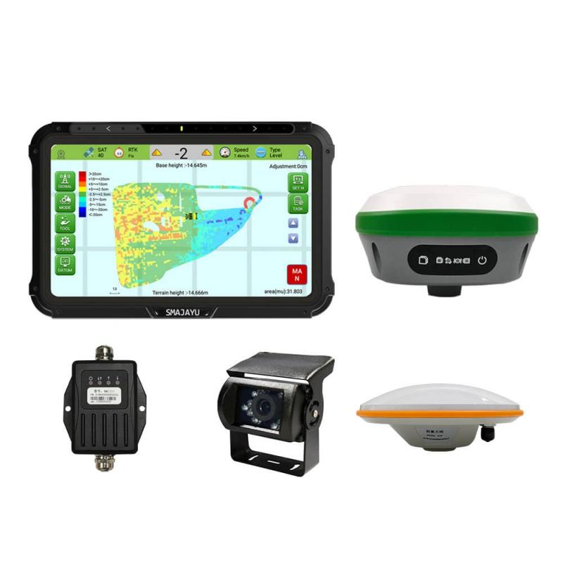
SMAJAYU takes pride in delivering top-notch GPS land levelling systems that meet the highest standards of quality and precision. Their products are built using cutting-edge technology and undergo rigorous testing to ensure accurate and reliable performance in the field. Whether you are levelling large agricultural fields or smaller plots, SMAJAYU offers a range of system options to cater to your specific needs. With their advanced GPS technology, you can achieve precise land levelling, resulting in optimal water distribution and improved crop uniformity.
2. Comprehensive Support and Training
Implementing a GPS land levelling system may seem daunting at first, especially for those who are new to this technology. However, SMAJAYU goes the extra mile to provide comprehensive support and training to their customers. Their team of experts is readily available to assist you throughout the entire process, from system installation and calibration to troubleshooting and maintenance. SMAJAYU understands that a successful partnership goes beyond the sale of their products and aims to ensure that their customers have the knowledge and resources to utilize their GPS land levelling systems effectively.
3. Cost-Effective Solutions for Increased ROI
Investing in a GPS land levelling system is a strategic decision that can bring substantial returns in the long run. SMAJAYU recognizes the importance of cost-effectiveness for their customers and offers solutions that provide a significant return on investment (ROI). By accurately levelling your land and optimizing water distribution, you can minimize water wastage, reduce irrigation costs, and improve crop yields. SMAJAYU’s GPS land levelling systems are designed to help you achieve these goals, enabling you to maximize your profits while minimizing expenses.
4. Customization and Adaptability
Every farm and landowner has unique requirements and preferences when it comes to land levelling. SMAJAYU understands this diversity and offers customizable solutions to cater to individual needs. Whether you require specific features, integration with other farm management systems, or compatibility with different equipment, SMAJAYU can tailor their GPS land levelling systems accordingly. Their flexibility and adaptability ensure that you can seamlessly incorporate their technology into your existing operations without major disruptions or compromises.
5. Reliable After-Sales Service
A supplier’s commitment to after-sales service is a crucial factor to consider when choosing a GPS land levelling system supplier. SMAJAYU prides itself on its prompt and reliable after sales service. Ensure customers receive ongoing support even after the initial purchase. They provide regular maintenance, software updates and technical assistance. to ensure your GPS land formation system will perform at its best for years to come. With SMAJAYU, you can have peace of mind. Because you know that whenever you need help or guidance, you have a dedicated partner you can trust.
Conclusion:
GPS Land Levelling systems have revolutionized precision agriculture by providing farmers with accurate positioning and real-time data analysis capabilities. By utilizing these systems, farmers can optimize field topography, enhance water management, and ultimately increase crop yields and profitability. With advanced technologies like GPS Land Levelling, farming operations can become more efficient, sustainable, and aligned with the demands of modern agriculture. As the adoption of precision agriculture continues to grow, GPS Land Levelling systems are poised to play a vital role in shaping the future of farming practices.
