

What does the GNSS land leveling system mean?
Modifying land elevation to the appropriate grade is known as land levelling, sometimes land grading or land formation. The main goals of land levelling are to increase drainage and agricultural output. Due to its precision and effectiveness, GNSS-based land levelling has grown in importance in recent years.
The technique of utilizing GPS or other satellite-based positioning systems to measure the height of a piece of ground is known as the GNSS land levelling system. The land’s surface may then be mapped using this information, which can subsequently be utilized for several things, including agricultural planning, building, and surveying.
What is the process for the GNSS land leveling system?
The (GPS) is a surveying tool that may be used to ascertain the elevation of a specific spot on the surface of the Earth. With this technology, it is possible to map the contours of the terrain and measure the heights of mountains, buildings, and other structures.
GNSS land levelling system is a quick and precise approach to level land for building projects, farming, or any other kind of land development.
The significance of levelling agricultural land:
There are several reasons why levelling agricultural land is essential. For crops to grow correctly and for farmers to work effectively, fields must be level. The levelling of land can be facilitated and accelerated with the use of land levelling equipment. Agricultural land levelling eliminates high and low places from the field to produce a consistent surface. Leveling agricultural land is essential for drainage and waterlogging prevention. Waterlogging may harm crops, making it challenging for farmers to work in their fields.
The use of the GNSS land levelling system:
The GPS, a space-based satellite broadcasting direction-finding method, needs an unhindered line of vision to four or more GPS satellite broadcasting to offer position and period evidence in all climate situations anywhere on or near the World.
- Development:
There are various advantages to using GNSS equipment in construction projects, including improved accuracy and productivity in levelling, surveying, and excavation. GNSS systems may be used to represent building sites in three dimensions. Construction sites for buildings, roads, and other infrastructure projects are prepared using this method.
- Landscaping:
Global navigation satellite systems (GNSS) land levelling are used in landscaping to provide a level surface. Construction and gardening projects frequently employ this method. Using GNSS for land levelling has various advantages, such as increased accuracy, quicker levelling, and the capacity to level on slopes. Because it helps generate level surfaces—crucial for good drainage and irrigation—the GNSS land levelling system is significant for landscaping.
- Farmland:
One of the most significant economic resources in the world is farmland. Food security and economic growth depend on the effective utilization of farms. The land level is one of the most important aspects of productive farms. Numerous facets of farming, such as tillage, planting, irrigation, drainage, and yield, are influenced by land level. In recent years, the use of GNSS for levelling agriculture has drawn increasing interest. High precision, extensive coverage, and real-time monitoring are features of this technology that can satisfy the demands of contemporary agricultural production.
Why GNSS Land leveling system is significant?
Increased yields, better water management, and lower input costs can all be achieved by using GNSS-based land levelling to make fields more level.
Creating a level field surface is the major goal of land levelling since it is necessary for the equipment and agricultural methods used in contemporary agriculture. Land levelling has been completely transformed, becoming more precise and efficient thanks to GPS-based technology.
- Less issue with topsoil erosion:
A more level surface may be made using the GNSS land levelling technology, which can help with soil compaction issues.
For farmers, soil compaction is a major issue. Crop yields are decreased, fuel expenses are raised, and equipment is damaged. A novel technique to lessen soil compaction is GNSS-based land levelling. The quantity of levelling material put on the land is adjusted after measuring the height of the land using GPS.
- Decreased water use:
The most notable benefit of GNSS land levelling is the potential for a large decrease in water use. Farmers may cut their water use by as much as 30% with appropriate field levelling. In addition to conserving water, this lowers the energy needed to pump water to the fields.
- Higher agricultural yields:
In recent years, land levelling and the creation of digital terrain models (DTMs) has both become more common uses for Global Navigation Satellite Systems (GNSS). This technique offers a quick and precise way to level a field surface, which might lead to higher agricultural yields.
- Lowered expenses:
A method called GNSS land levelling can level ground rapidly and precisely. By minimizing the time and work needed to level your land, GNSS land levelling can help you save money. Using this technology can also assist you in avoiding costly errors like levelling your property incorrectly. By using this technique, land levelling costs can be cut by up to 50%. The efficiency of land levelling can be increased by up to 30% by using GNSS land levelling.
Conclusion:
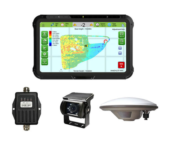
A surveying method known as the GNSS Land Leveling System keeps track of and manages land surfaces using the satellite-based Global Direction finding Satellite Broadcasting System. This technique is used to grade the land for building and other uses and to make contour maps. The advantages of employing a GNSS Land Leveling System will be covered in this article. In addition to measuring topographic characteristics and keeping track of deformation, it may be used to establish and manage GNSS control networks. The device can level up to 20 hectares (50 acres) of land and comes with a GNSS receiver, antenna, and display. The JYL20’s integrated GPS receiver offers precise readings up to 10 metres away. The SMAJAYU is the ideal instrument for anyone who needs to determine the altitude of a certain spot.
