

What is meant by survey equipment?
Survey equipment refers to a broad range of specialized tools and equipment used in the surveying industry. Surveying is the process of calculating and tracing the physical characteristics of the surface of the Earth. This procedure is necessary for several tasks, including building, land development, mapping, and producing precise geographic data. Professionals can produce accurate maps, blueprints, and models by using survey equipment to collect exact measurements and data.
Why Survey Equipment for Sale is Essential Tool for Precision and Efficiency?
Accuracy and precision are now essential in many businesses due to the fast-paced nature of today’s society. Surveying is one such sector that is very reliant on precision. Survey equipment is essential for guaranteeing accurate measurements, whether taken for topographic surveys, mapping purposes, or land borders. Survey equipment for sale is crucial in assuring accuracy and effectiveness across various applications. Professionals in industries like land surveying, building, mapping, and environmental monitoring require these cutting-edge instruments since they provide several advantages that considerably improve the quality and accuracy of the job completed.
The capacity of survey equipment:
The capacity of survey equipment to give precise measurements and data is one of the main reasons it is essential for accuracy. Accuracy is crucial in projects where even little mistakes can have major repercussions. Total stations and GNSS receivers are examples of tools with high degrees of precision that enable surveyors to record exact angles, distances, and coordinates. This precision translates to more trustworthy modelling, layout, and mapping, which leads to better judgements and less rework.
The efficiency of survey equipment:
Efficiency is also another important factor that survey equipment contributes. The traditional manual surveying techniques can be labour- and time-intensive. On the other hand, modern survey technology automates and simplifies the data-collecting procedure. For example, integrated GNSS receivers can quickly establish locations without needing elaborate setup, and laser scanners may quickly and efficiently capture comprehensive 3D data. These time-saving tools shorten project timeframes and give surveyors more time to concentrate on other important facets of their jobs.
Additionally, survey equipment aids in the effective processing and interpretation of data. Many of these technologies are intended to interact easily with software systems that help experts organize, visualize, and analyze data more skilfully. This integration improves the speed at which choices can be made using the gathered data and decreases the manual work needed for data manipulation.
The adaptability of survey equipment:
Another aspect that increases the usefulness of survey equipment is its adaptability. Surveyors want instruments that can be adjusted to various situations since different projects have different needs. Modern survey equipment has a broad range of functions that respond to varied demands, making it a vital tool in today’s dynamic work situations. These functionalities include measuring distances, taking 3D models, and remotely detecting environmental variables.
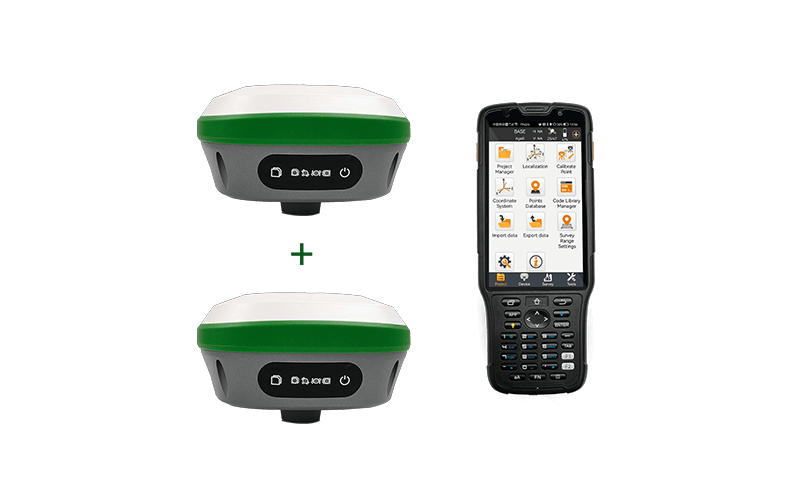
Main characteristics of the Survey equipment for sale: R26 Surveying System
The R26 Surveying System, survey equipment for sale, is a cutting-edge and all-inclusive solution created to meet the demands of contemporary surveying and mapping projects. With its cutting-edge technology and precision instruments, the R26 System provides professionals with the tools to accurately and effectively gather data, create maps, and generate models for various applications.
- High-precision GNSS receiver included in the R26 System:
This feature enables precise positioning and location determination. It guarantees accurate and timely positioning data by supporting numerous satellite constellations, including GPS and GLONASS.
- The functionality of a total station:
This system smoothly blends the abilities of a GNSS receiver and total station. It provides precise point positioning and layout for building, land development, and engineering projects since it can measure angles and distances.
- Robust Data collecting:
The R26 System is equipped with sophisticated data-collecting tools. It is suited for various terrains and circumstances since it can take accurate measurements, angles, and distances even in difficult surroundings.
- Remote Sensing:
The R26 System’s integrated remote sensing technology allows it to collect precise data at a distance, which makes it perfect for uses like forestry, environmental monitoring, and extensive topographic mapping.
- Real-time Communication:
Thanks to the system’s real-time communication features, surveyors may send and receive data and instructions in real-time. This shortens project turnaround times, improves teamwork, and streamlines the surveying process.
The R26 System has a simple, easy-to-understand user interface that simplifies operations and shortens the learning curve. This is very helpful for field teams who must swiftly adjust to new tools and technology.
- Data Integration:
The R26 System enables easy data processing, analysis, and visualization for surveyors by integrating various software platforms. The decision-making process is sped up, and this integration improves data accuracy.
- Durability and Portability:
The R26 System was created with durability in mind. It was engineered to survive difficult field conditions. Because of its tough design, it can withstand harsh conditions while yet being portable for simple movement between survey locations.
- Versatility:
The R26 System offers a flexible system that can handle various surveying demands, whether used for land surveying, construction planning, environmental monitoring, or infrastructure development.
- Data Security:
The system has strong data security mechanisms to protect sensitive survey data throughout collection, transmission, and storage. This maintains the data’s integrity and confidentiality. The R26 Surveying System, in conclusion, is a complete and complex tool that enables surveying experts to collect precise data, produce intricate maps, and produce models for various purposes. The R26 System is invaluable for contemporary surveying projects because it combines GNSS technology, total station functionality, remote sensing capabilities, and a user-friendly interface, increasing efficiency, precision, and successful project results.
Conclusion:
Survey equipment for sale is more precise, effective, and dependable than ever; surveys have undergone a technological revolution. Professionals in various fields, including land surveying, engineering, and construction, continuously search for the newest and most cutting-edge instruments to improve their job. This is because survey equipment is continually changing. SMAJAYU offered changeable attachments by vehicle standards to increase flexibility and prevent equipment usage from being restricted to a particular kind of farm vehicle. Software with a user-friendly interface makes controlling field operations simple.
