

The introduction of agriculture GPS guidance system:
A breakthrough age in contemporary agricultural techniques has begun with the development of GPS guiding devices for agriculture. The way farmers approach their operations has been profoundly changed by these cutting-edge technologies, which were created on the GPS platform. Farmers have attained previously unheard-of levels of efficiency, production, and sustainability thanks to the agriculture GPS guidance system, which offers precise and accurate navigation aids for various agricultural tasks.
The era of manual estimation and inefficient resource use is over. Farmers may now accurately manage their fields using GPS-guided equipment, reducing overlaps and gaps during operations like planting, spraying, and harvesting. This accuracy results in considerable cost savings in addition to conserving vital resources like seeds, fertilizer, and pesticides. Additionally, there are significant environmental advantages; focused application lowers runoff, protects water quality, and encourages ecologically friendly farming methods.
Agriculture GPS guidance systems are modernizing precision farming practices:
Global Positioning System (GPS) navigation devices for agriculture have recently changed precision farming techniques. These cutting-edge technologies have significantly changed agriculture by improving production, efficiency, and sustainability. Let’s examine how GPS guiding systems for agriculture have facilitated this change:
- For various farm tasks, GPS-guided equipment provides precise and accurate navigation. This degree of precision aids in avoiding gaps and lowering overlaps while also ensuring that every square inch of the field is used to its full potential. This accuracy is especially crucial for operations like planting, applying pesticides, and harvesting.
- Farmers may prevent overlap when doing tasks like seeding or spraying fertilizer and pesticides with the help of precise GPS guidance. As a result, there is less input waste since the machinery just treatments the targeted regions, using fewer resources and saving money.
- Farmers may save a lot of money by using resources like seeds, fertilizer, insecticides, and gasoline. Cost-effective agricultural techniques result from decreased input waste and increased effectiveness.
- Precision farming, made possible by GPS navigation devices, lessens agriculture’s negative environmental effects. Farmers may reduce runoff and soil pollution, protect water quality, and promote more sustainable farming practices by using only fertilizers and pesticides where necessary.
- Numerous GPS navigation systems use data-collecting tools like sensors and remote sensing. Farmers may now collect information on the condition of the soil, moisture levels, crop development, and other topics. Farmers may make educated judgments and modify their operations by analyzing this data.
- Equipment that uses GPS guidance can apply inputs at different rates. As a result, various field areas are treated differently depending on their unique requirements, which are identified through data analysis. This focused strategy optimizes agricultural yields while the environmental effect is reduced.
- Farmers may operate machinery more precisely and effectively using GPS direction, reducing the time needed for planting, growing, and harvesting. This time savings is beneficial, especially during the busiest planting and harvesting seasons.
- The agriculture GPS guidance system may eliminate manual technical requirements, ensure precise operation line spacing and direction, and increase operation accuracy and labour efficiency.
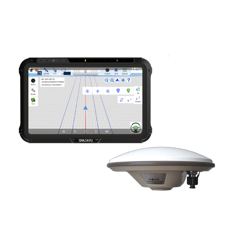
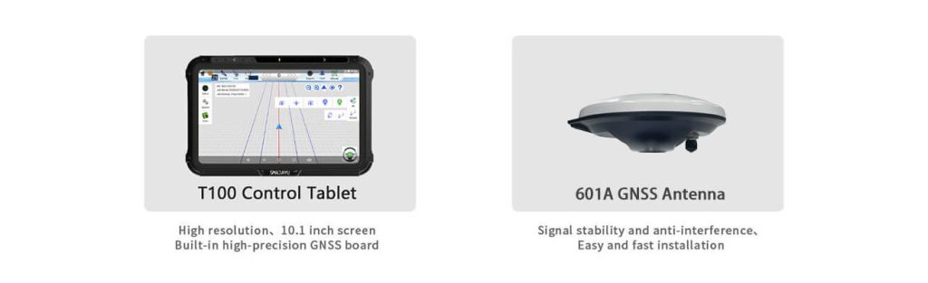
The features of the SMAJAYU JY100 Tractor GNSS Guidance System:
- A professional GNSS smart antenna, a huge display, and guiding software make up the JY100 guidance system.
- It would be the ideal guidance option for the precision farmer of today. The software offers a farmer-friendly user interface and big, recognizable buttons for every function.
- It has 3-click navigation, suitable for people who need more training or guide expertise.
- With JY100, you can effortlessly do various agricultural activities, increase your farm’s output, and extend your operation hours. It is reliable, accurate, and economical.
- Thanks to a high-precision positioning board, the maximum centimetre-level positioning 2.5cm precision RTK guiding system may be attained without a base station connection.
- Remote management is made possible by the ability to examine work information in real-time and monitor job status thanks to cloud storage.
- The system may run nonstop for 24 hours to prevent failure to operate due to night vision issues.
- Strong anti-interference capability to withstand the hardest working circumstances. Support GNSS four-system full-band signal.
Yield Mapping and Analysis Using GPS for Agriculture: Revolutionizing Precision Agriculture
The introduction of GPS technology into contemporary agriculture has ushered in a new era of precision agricultural techniques. Among its revolutionary uses, yield mapping and analysis are potent instruments that have revolutionized how farmers comprehend and maximize crop output. The mapping and analysis of yields have been completely transformed using an agriculture GPS guiding system, giving farmers hitherto unreachable information.
- Yield Mapping: Understanding Crop Variability
Data must be gathered and analyzed for yield mapping to determine the various productivity levels in a field. Agriculture GPS guiding devices have helped this procedure become more precise and effective. Integrated sensors measure yield and position information in real time as equipment moves across the field. The field’s productivity fluctuations are then visually shown on detailed yield maps using this data.
- Harnessing Data Analysis’s Power:
For farmers, the data gathered by GPS-guided yield mapping is a gold mine of information. The yield maps may be thoroughly analyzed using sophisticated tools, revealing patterns, trends, and correlations that help decision-making. Farmers can modify their operations to address certain issues or take advantage of effective tactics by identifying regions that regularly produce more or less than others.
- Making Accurate Decisions for Best Results:
Farmers can carry out precise interventions by accessing exact yield maps and analyses. Based on the field’s production zones, a variable rate application of seeds, fertilizer, and pesticides can be planned. This focused strategy not only maximizes yields but also minimizes input wastage, lowering expenses and less negatively impacting the environment.
- Facilitating Ongoing Improvement:
Yield mapping is a dynamic process that allows continuous improvement; it is not a one-time project. Farmers may evaluate the success of their interventions and change their techniques as necessary by comparing yield maps from several seasons. This repeated process eventually results in improved procedures and increased output.
Conclusion:
The agriculture GPS guidance system, a huge display, and guiding software comprise the JY100 guidance system. It would be the ideal guidance option for the precision farmer of today. The software offers a farmer-friendly user interface and big, recognizable buttons for every function. It has 3-click navigation, suitable for people who need more training or guide expertise. With JY100, you can effortlessly do various agricultural activities, increase your farm’s output, and extend your operation hours. It is reliable, accurate, and economical. To guarantee goods with great performance, high reliability, stability, and robustness, SMAJAYU has a stringent inspection procedure.
