


SMA26 PRO RTK Rover
$1,595.00
Stars,100% Recommend
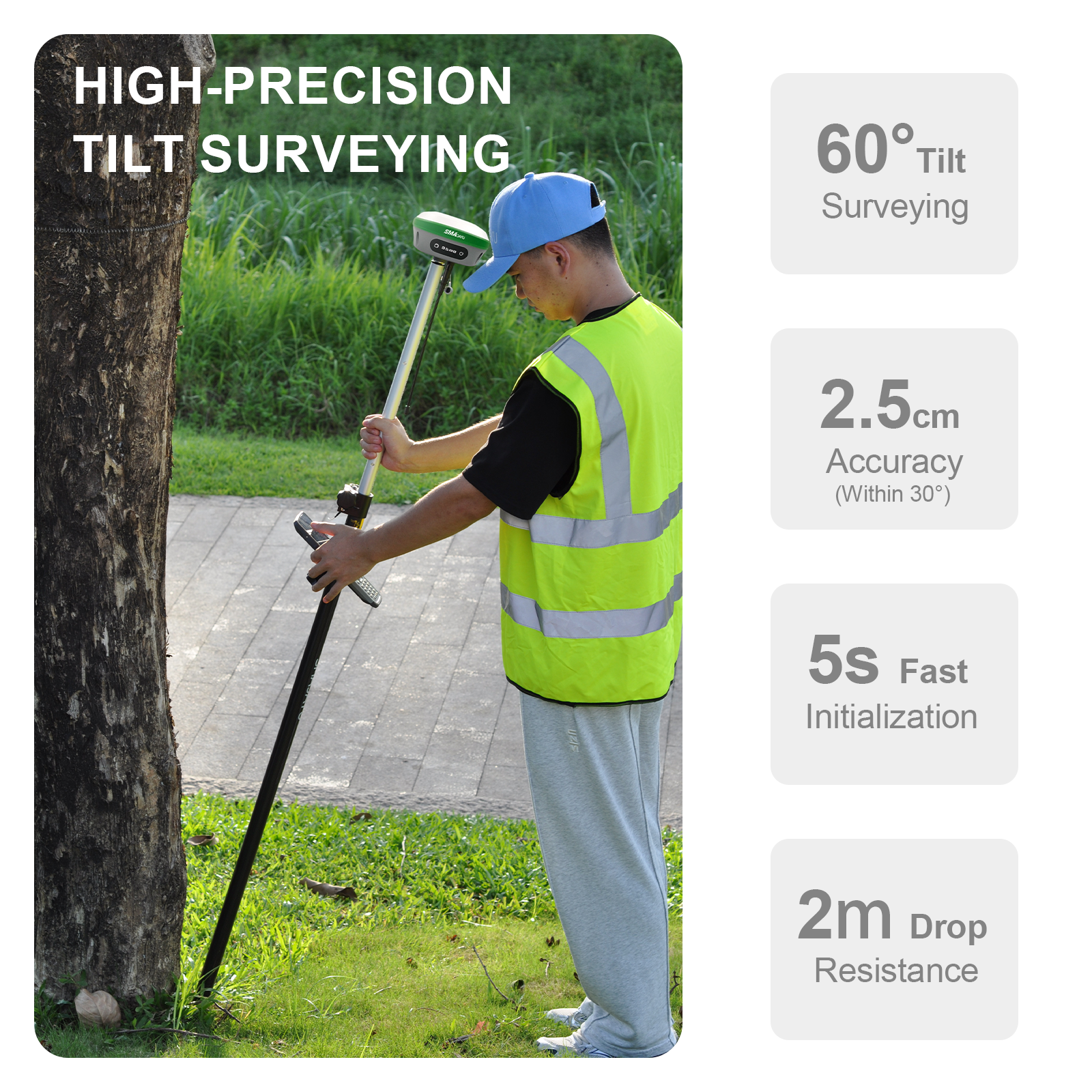
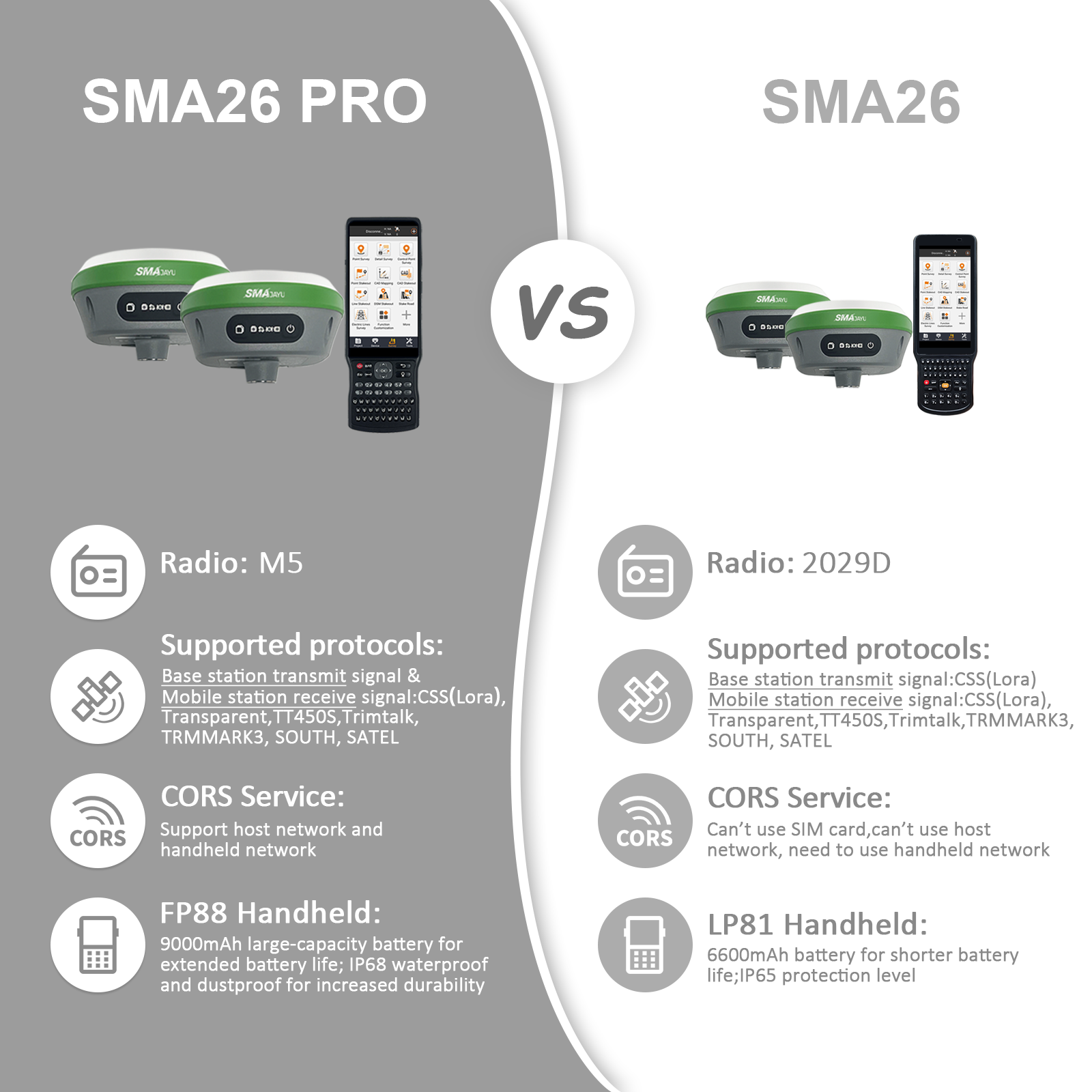
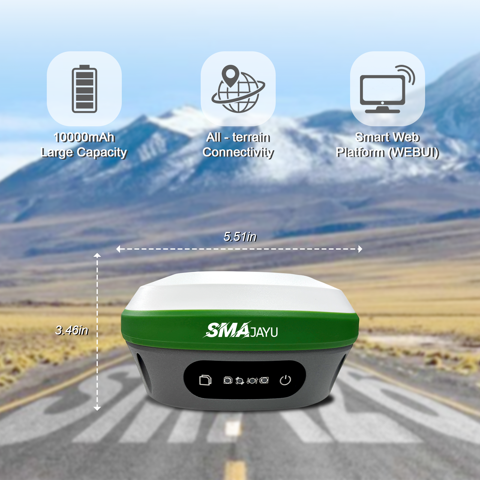
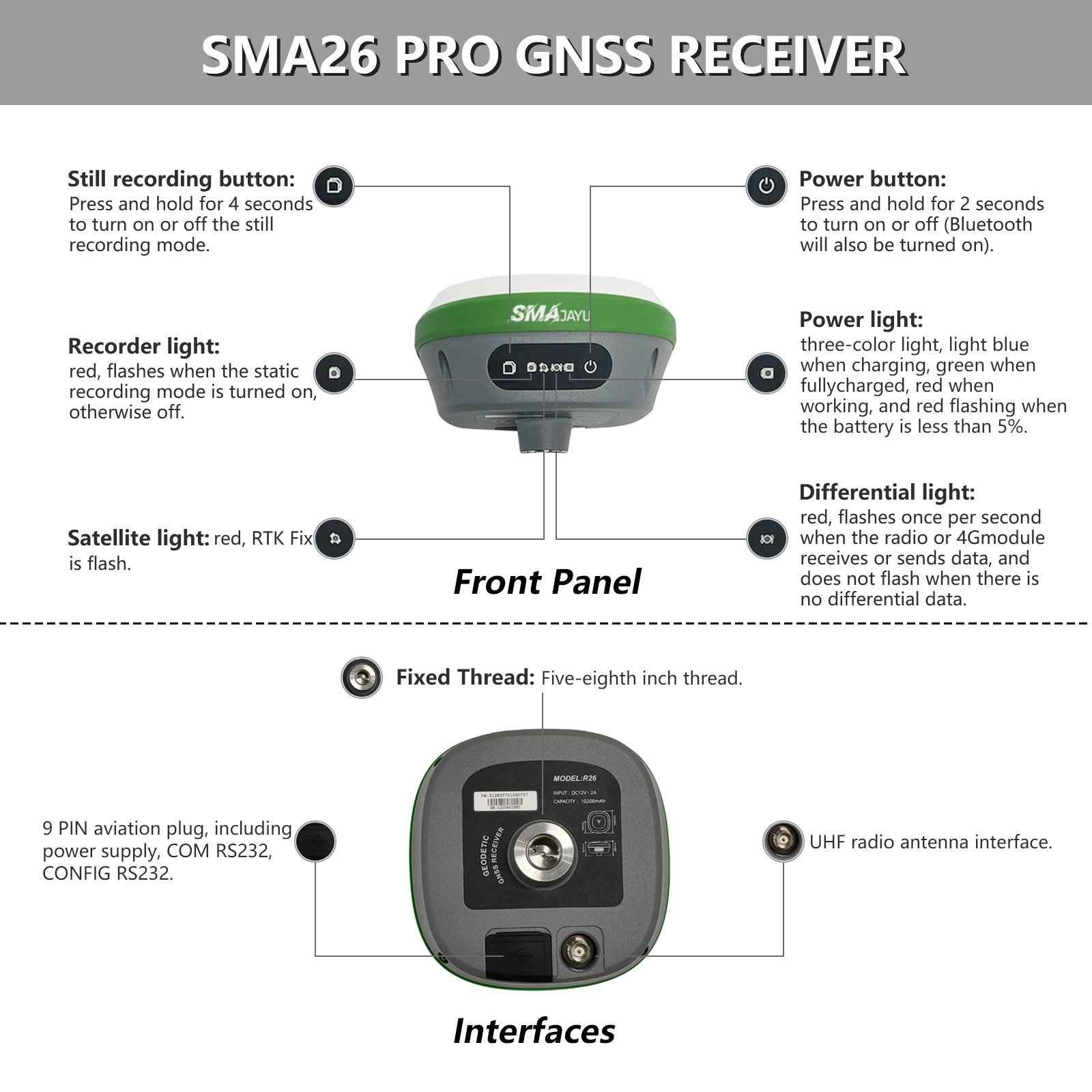
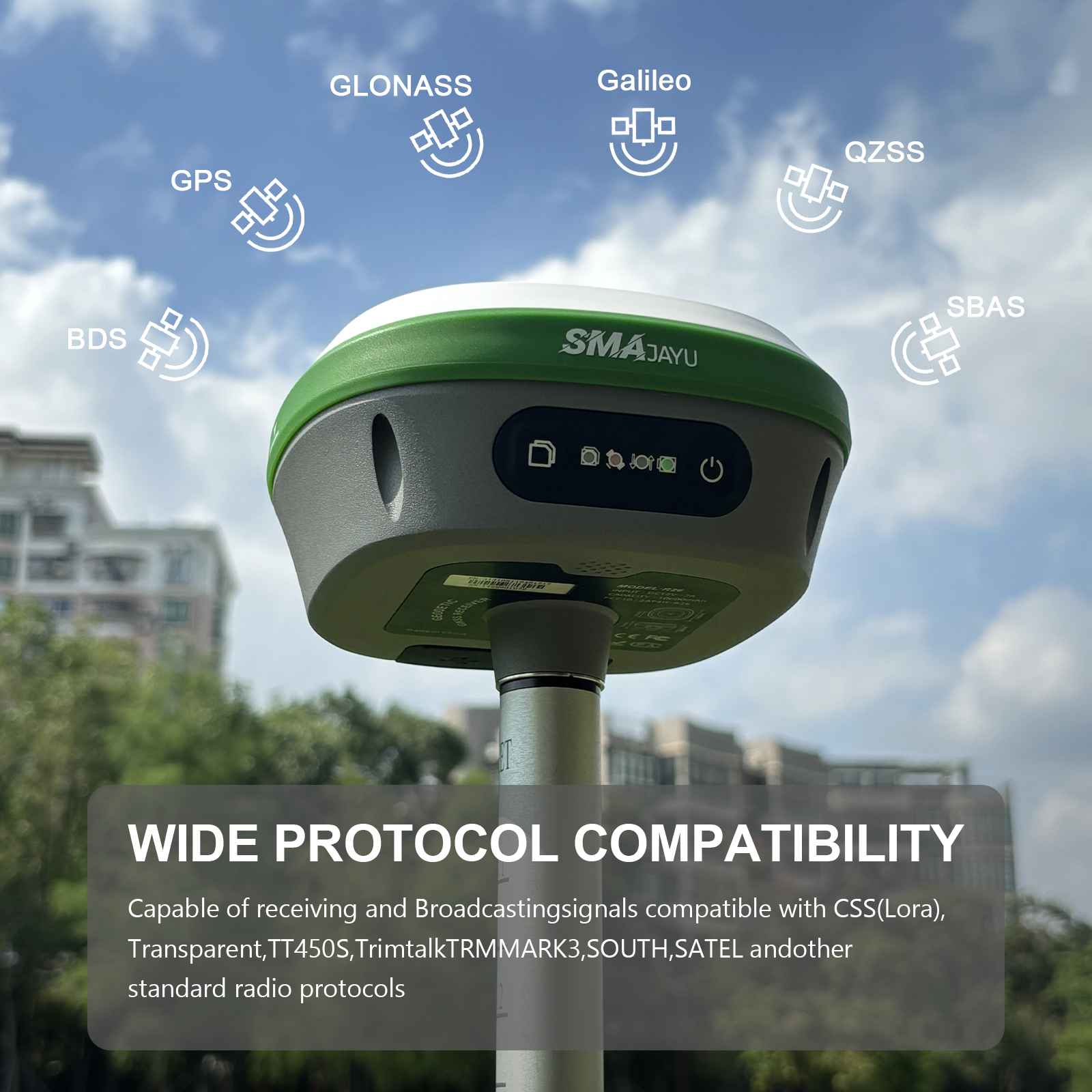
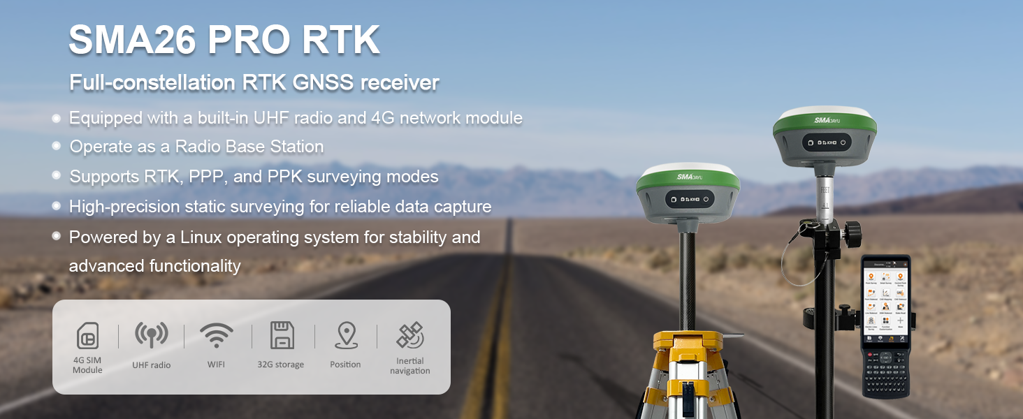
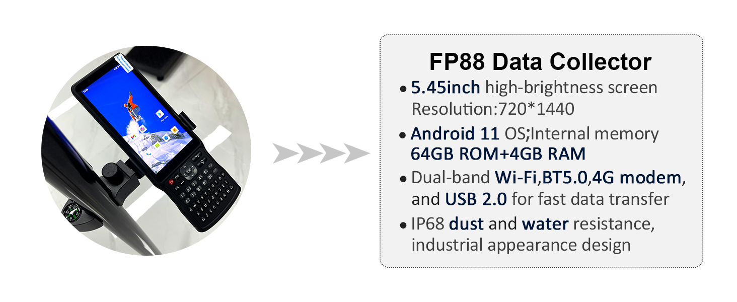
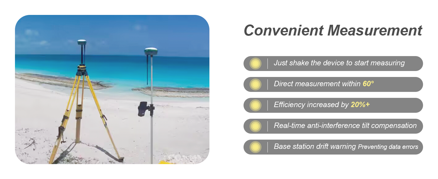
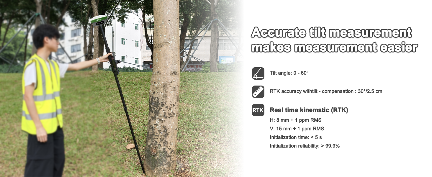
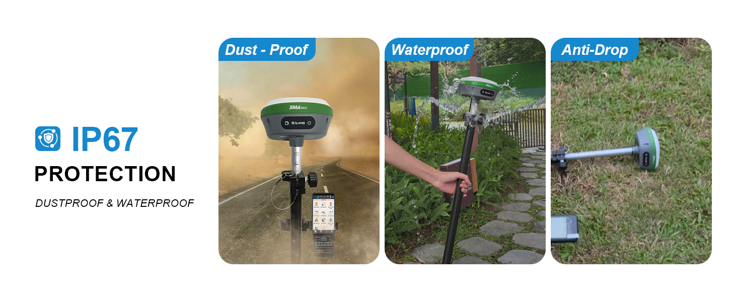
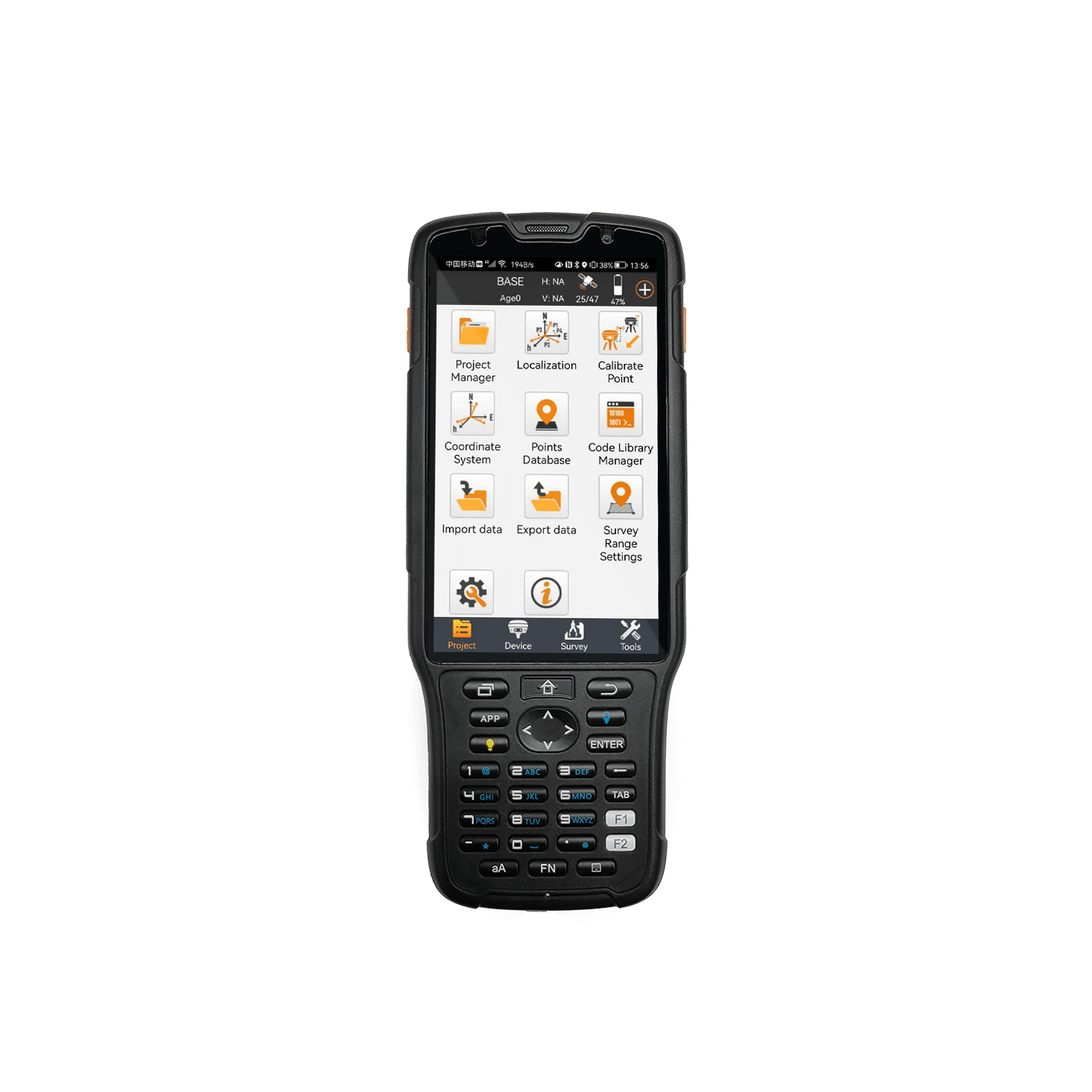
【Tilt Compensation】 The SMA26 Pro GNSS RTK offers a tilt accuracy of up to 2.5 cm (at tilt angles ≤30°), allowing for precise measurements in hard-to-reach areas without calibration, and supports a maximum tilt measurement angle of up to 60° 【Smart Handheld Collector】This SMA26 Pro RTK Rover receiver features an Android 11 handheld unit with a 5.45-inch HD screen, dual SIM card slots, a 9000mAh battery, NFC functionality, IP68 protection rating, dual-frequency RTK support, and a 13-megapixel rear camera 【Wide Protocol Compatibility】SMA26 Pro RTK GPS surveying equipment can receive and transmit signals compatible with CSS (Lora), Transparent, TT450S, Trimtalk, TRMMARK3, SOUTH, and SATEL standard radio protocols, ensuring compatibility with a variety of mobile stations and base stations 【All-in-One Integration】The SMA26 Pro RTK GNSS receiver features built-in Bluetooth, UHF radio, 4G, Wi-Fi, an inertial measurement unit (IMU), an antenna, and 32GB of storage. A single device allows for easy switching between base station and rover modes 【Rugged & Reliable】The SMA26 Pro GNSS RTK features IP67 waterproof and dustproof rating and is drop-resistant up to 2 meters. It can operate in temperatures ranging from -45℃ to +75℃. Equipped with a 10000mAh battery, it provides up to 20 hours of continuous operation
- Benefit
- Specification
- Download
- Reviews


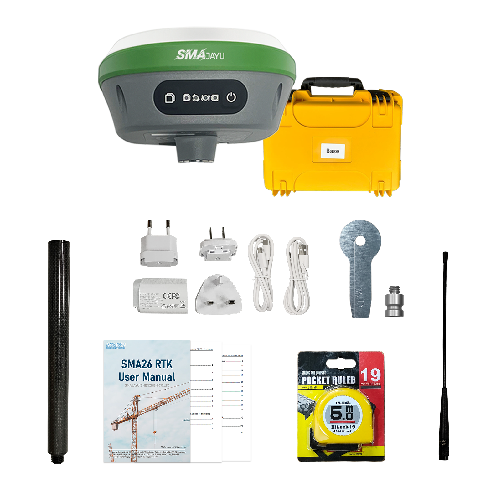
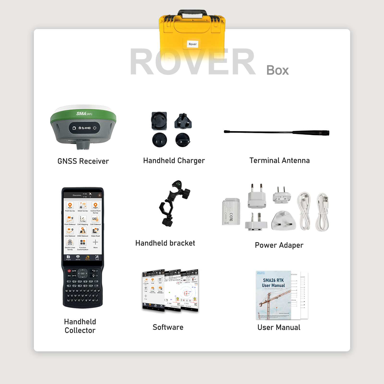
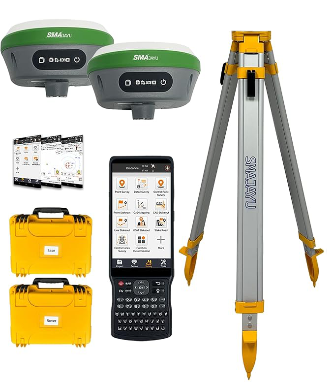
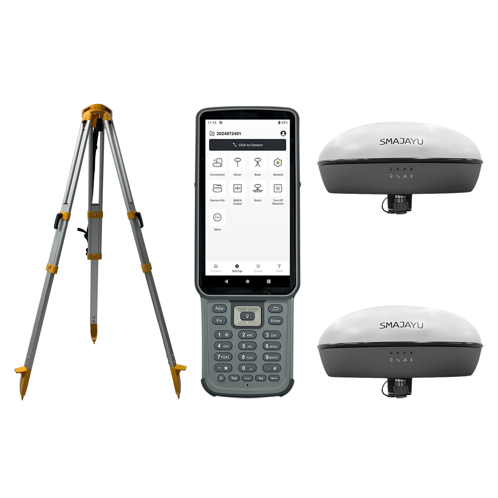
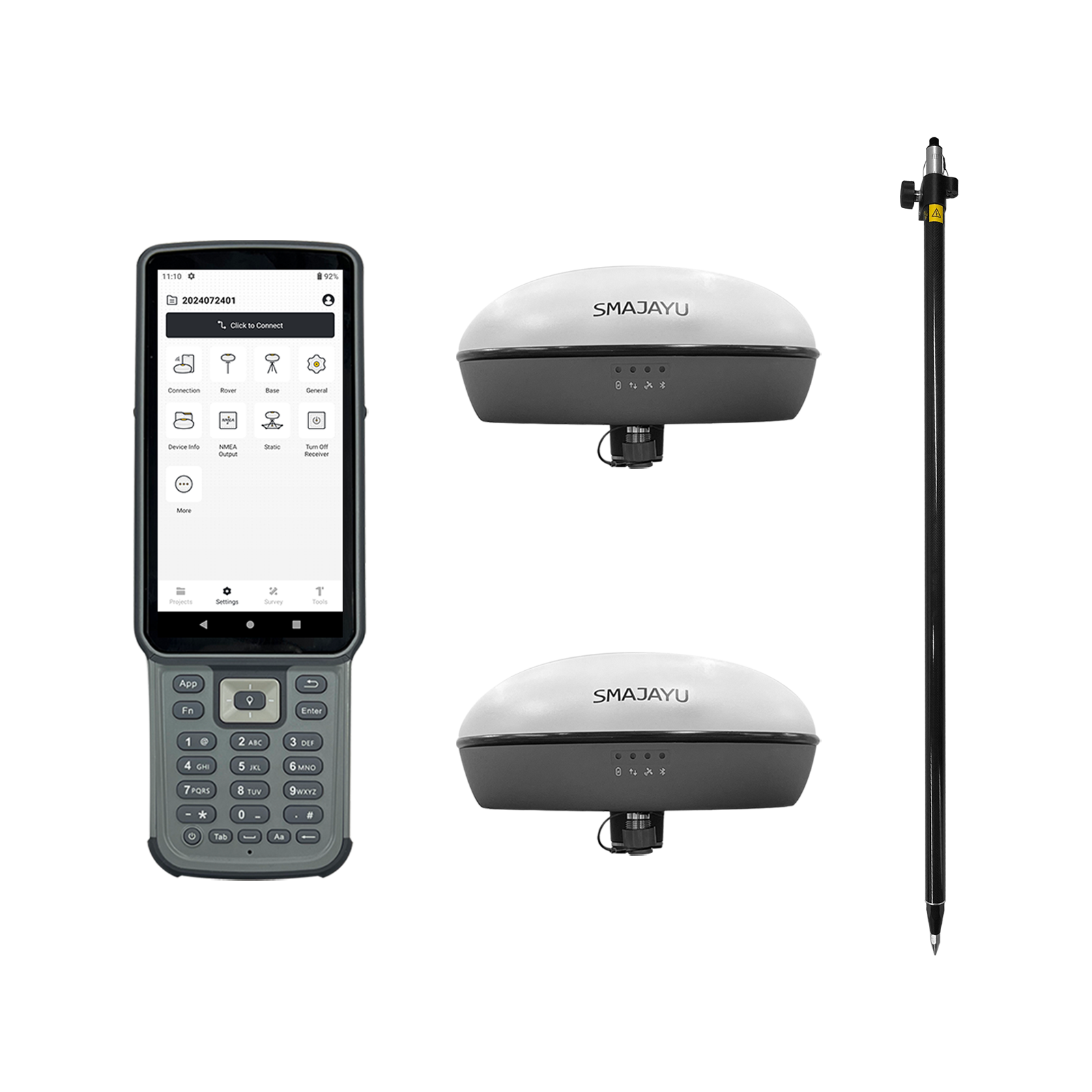
SMA26 PRO Survey System
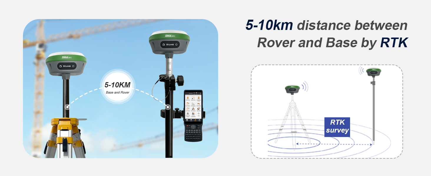
The SMA26 PRO survey system is a survey system including Handheld; it integrates the advantages of high precision, low power consumption, small size, convenient and fast portability and operation. It can meet various engineering needs of surveying and mapping industries. The system consists of two SMA26 PRO GNSS receiver and a Handheld, Handheld with surveying software. The software interface is clear, easy to learn and understand, convenient and practical, making work easier, faster and more efficient. It can be widely used in surveying and mapping industries such as land, construction, forestry, roads, electric power, water conservancy, oil pipelines, etc.
New 4G RTK
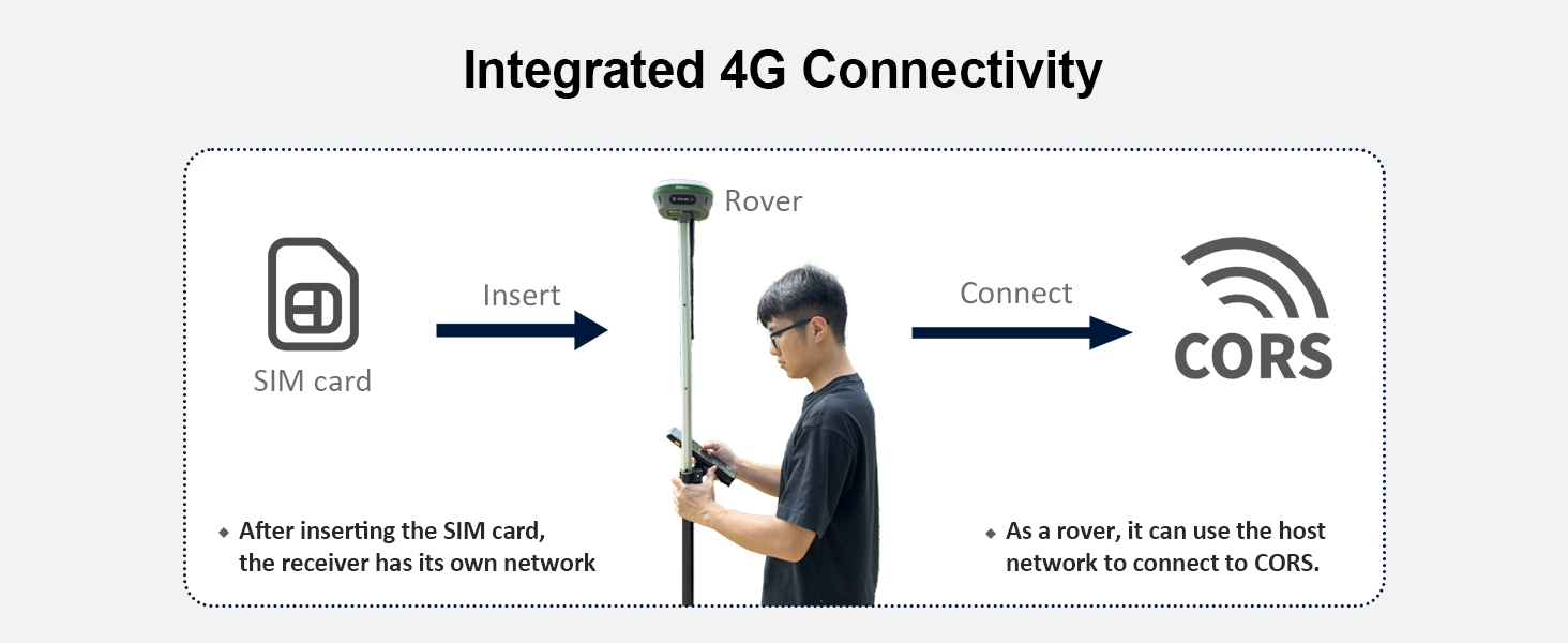
Plug in the SIM card and use it immediately. Dual mode integrated design, supporting direct connection to CORS real-time measurement or self built CORS benchmark station networking, efficient and accurate, and flexible adaptation to diverse surveying and mapping scenarios.
NEW LINUX OPERATING SYSTEM
Linux intelligent operating system, supporting voice playback, 4G, WEBUI, and WIFI connection. You can easily access and set up your device by opening a website and viewing its information. Experience hassle-free connectivity with our user-friendly interface. Advanced voice interaction capabilities and a convenient self-test function make device maintenance easy.
ALL-IN-ONE DESIGN
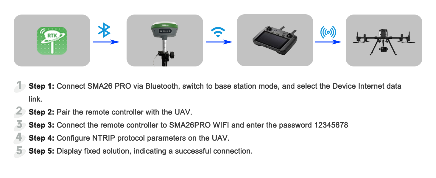
The device has built-in Bluetooth, radio, WIFI, storage, positioning, inertial navigation, and antenna modules. It can switch between base station mode and rover mode for automatic switching between the mobile and base station.
TILT COMPENSATION FOR HARD-TO-REACH MEASUREMENTS
The NebulasIV GNSS SoC integrates RF, baseband, and high-precision algorithms. It can track 40+ satellites for accurate positioning in complex environments. The built-in IMU module doesn’t require calibration and achieves a 2.5cm tilt measurement accuracy (≤30°) with simple initialization.
Related Products
SMA26 PRO RTK Rover
$1621
Reply to you within 24 hours
