

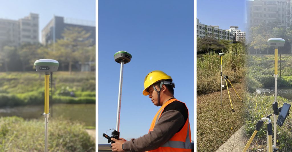
What is meant by GPS surveying?
- One approach of surveying known as GPS (Global Positioning System) surveying uses GPS technology to pinpoint the exact location of points on the surface of the Earth. GPS surveying uses satellites, ground-based control stations, and specialized tools to pinpoint the exact location of survey markers, borders, and other objects on the surface of the Earth.
- In order to determine a GPS receiver’s location on the ground, a network of GPS satellites is used in GPS surveying. In order to pinpoint its location on the surface of the Earth, the GPS receiver estimates the distance to a number of GPS satellites. The number of satellites accessible and the caliber of the GPS equipment utilized to determine how accurate surveying will be.
- In applications related to building, engineering, and land surveying, this surveying is frequently employed. It is especially helpful for surveying expansive regions, such as roads, pipelines, and power transmission lines, as well as for identifying and marking property lines and property borders. Geodetic surveying, which examines the Earth’s dimensions, gravitational field, and form, also uses GPS technology.
- Other methods used in surveying include total station surveying, laser scanning, photogrammetry, and GPS surveying. Each of these methods has benefits and drawbacks, and the choice of the method relies on the particular requirements of the survey.
What are the consequences of GPS surveying?
In order to gather information about the environment and create precise 3D models of the land, buildings, and other elements, the construction industry uses GPS surveying technology. Compared to conventional techniques, GPS surveying is quicker and more precise, and it has a number of advantages, such as enhanced safety, increased efficiency, decreased expenses, and improved accuracy. It is a form of geodetic surveying that makes precise measurements of angles and distances between places using satellites. The surveying business has undergone a transformation as a result of this technology’s ability to measure land more precisely and effectively than previous techniques.
A Novel Method for Accurate Mapping Using GPS-Based Surveying:
Modern surveying methods like GPS surveying provide precise measurements and maps of the Earth’s surface using GPS technology. With this method, survey sites on the ground are triangulated to determine their locations using a network of satellites circling the planet. In general, GPS-based surveying has a very high accuracy level, frequently within millimeters of the actual site.
- Firstly:
Compared to conventional surveying techniques, GPS-based surveying provides several benefits. It is first of all quicker and more effective. Conventional surveying techniques take several hours, or even days, to measure and chart a small region. Contrarily, GPS-based surveying has the ability to cover huge areas quickly.
- Secondly:
Second, compared to conventional surveying techniques, GPS-based surveying is far more precise. Human error is significantly decreased since it uses satellite triangulation rather than hand measurements. As a result, the maps and measurements produced are significantly more trustworthy and may be utilized in a variety of applications with more assurance.
- Thirdly:
Finally, GPS-based surveying is far more adaptable compared to conventional surveying techniques. It is perfect for various applications, from construction and engineering to agricultural and environmental monitoring, because it can be used to measure and map enormous regions quickly and precisely. GPS surveying is an effective method for precisely mapping and measuring the Earth’s surface. It is a vital approach for many sectors and applications thanks to its speed, precision, and adaptability, and as technology advances, its use is only going to grow over the next years.
What are the advantages of GPS surveying?
Compared to conventional surveying techniques, GPS surveying has a number of advantages, including:
- More precision:
As compared to older surveying techniques, GPS technology gives a better degree of accuracy. Survey sites may be located with centimeter-level precision, allowing for more accurate measurements and mapping.
- Saving time:
This surveying is significantly quicker than conventional surveying techniques. GPS surveying may save a substantial amount of time and money since it can cover big regions in a shorter amount of time.
- Cost-effectiveness:
Compared to conventional surveying techniques, this surveying may be more economical. GPS surveying can result in fewer field trips because of quicker survey times and greater accuracy, which also means cheaper travel, labor, and equipment expenses.
- Versatility:
GPS surveying technology has a wide range of uses, including environmental monitoring, mining, agriculture, and construction. Due to its adaptability, it is a useful tool for many different sectors. Using this surveying technology is simple and doesn’t require any expertise. Its simplicity of usage can cut down on the possibility of human mistakes and save time and money on training expenses.
- Remote capabilities:
This surveying technology may map and survey previously inaccessible regions in remote or difficult-to-reach areas. This surveying offers a variety of advantages, including improved accuracy, cost and time savings, adaptability, simplicity of use, and remote capabilities. Because of these advantages, GPS surveying is useful for many different types of businesses and applications.
Conclusion:
Technology had already experienced a 10-year shift from conventional to cutting-edge equipment when SMAJAYU was built in 2009. Intelligent agriculture has made it feasible to achieve our new goal of promoting agricultural growth. The highly accurate and cost-effective GPS surveying system promotes the application of agricultural technology on farms of all sizes. Using SMAJAYU agriculture guidance and auto-steer, coupled with GPS accuracy technology, precision farming to a centimeter is assured. As you may already be aware, employing a GPS enables you to boost your yields and profits. Farmers all around the world are trying the SMAJAYU product and then bragging about it to their family and friends when they return home. It shows not just how fantastic the GPS system is in terms of quality but also how it may be used to upgrade older tractors in a practical and affordable way.
