


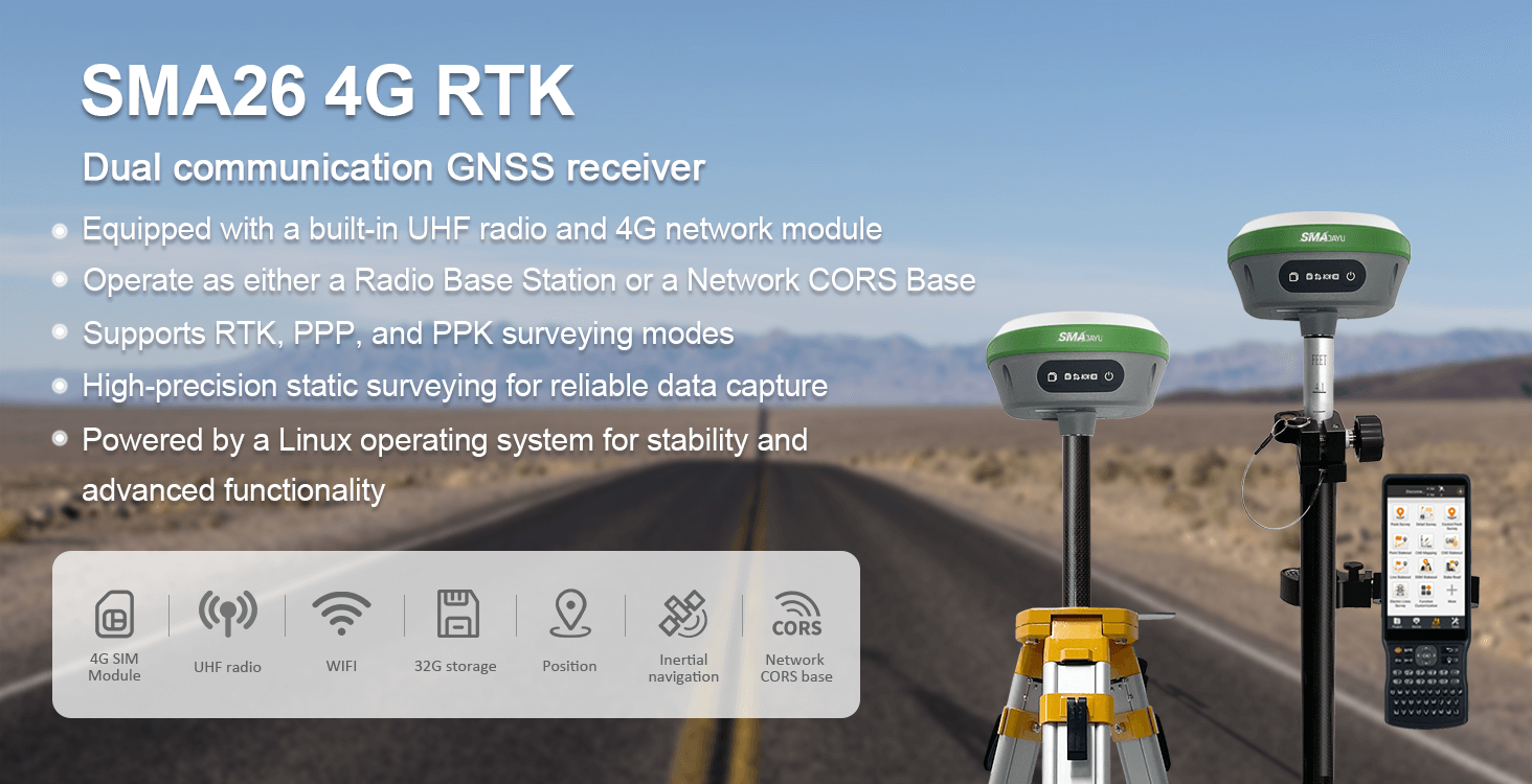
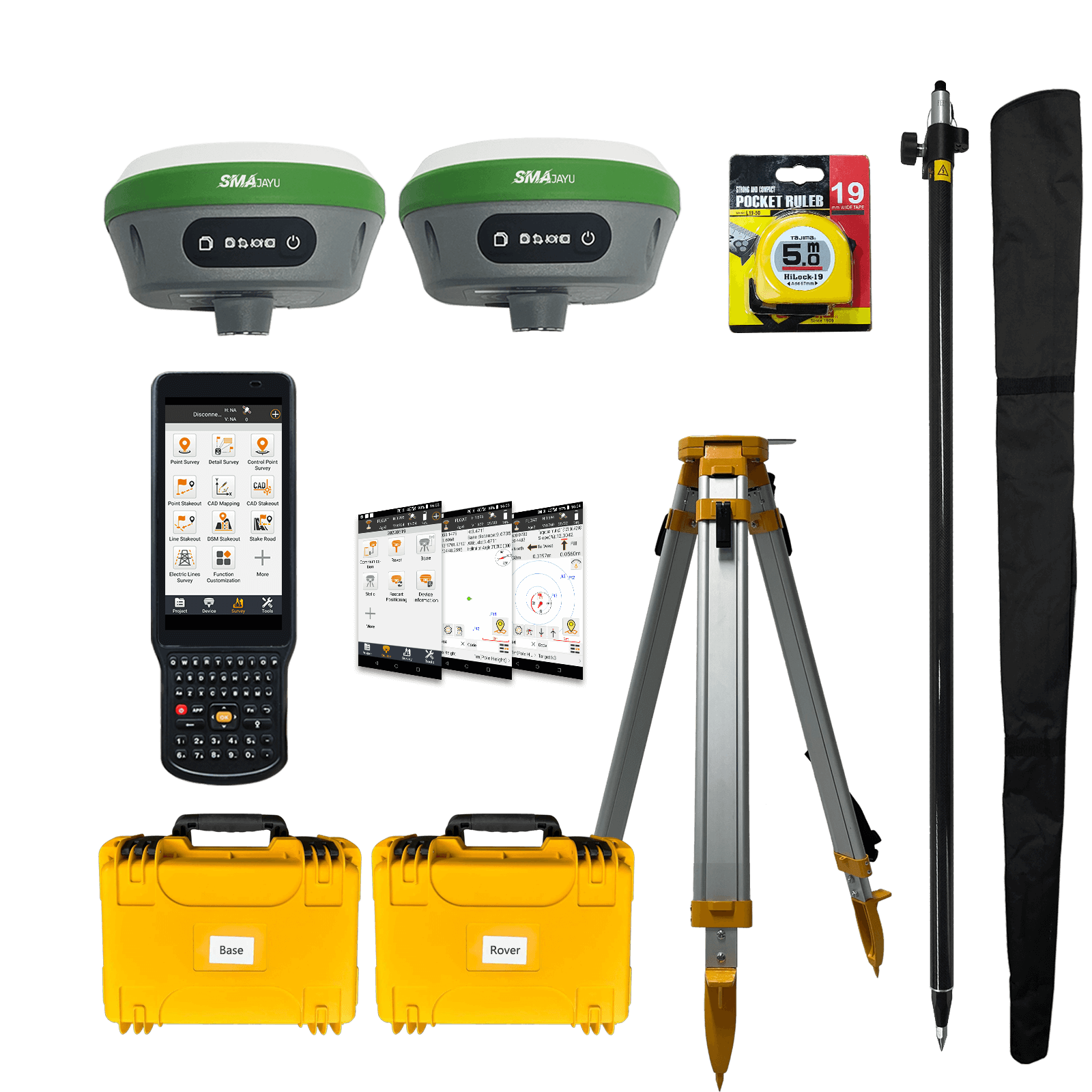
SMA26 4G RTK rover+base
$2,791.00
Stars,100% Recommend
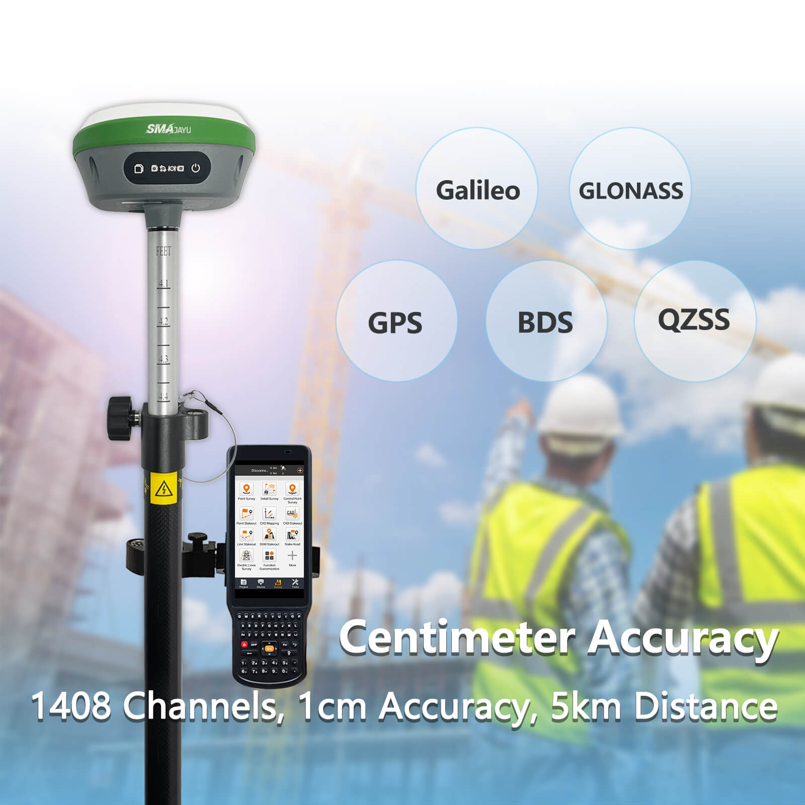
SMA26 V2 GNSS IMU RTK GPS Surveying Equipment Rover Base Handheld Collector and Survey Software, NOAA certificated, 1408 Channels, 1cm Accuracy
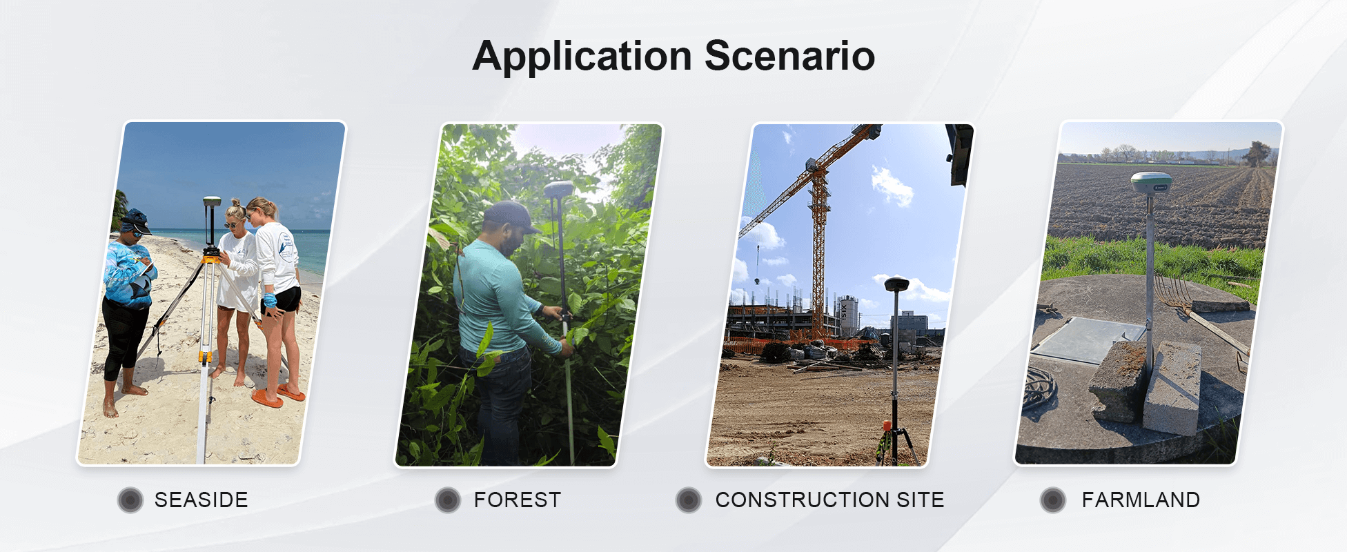
Ideal for construction and geodetic surveys.
low power, compact, easy to carry and operate.
Suitable for surveying, mapping, GIS, engineering, and mining.
- Benefit
- Specification
- Download
- Reviews
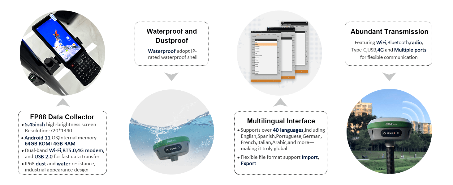
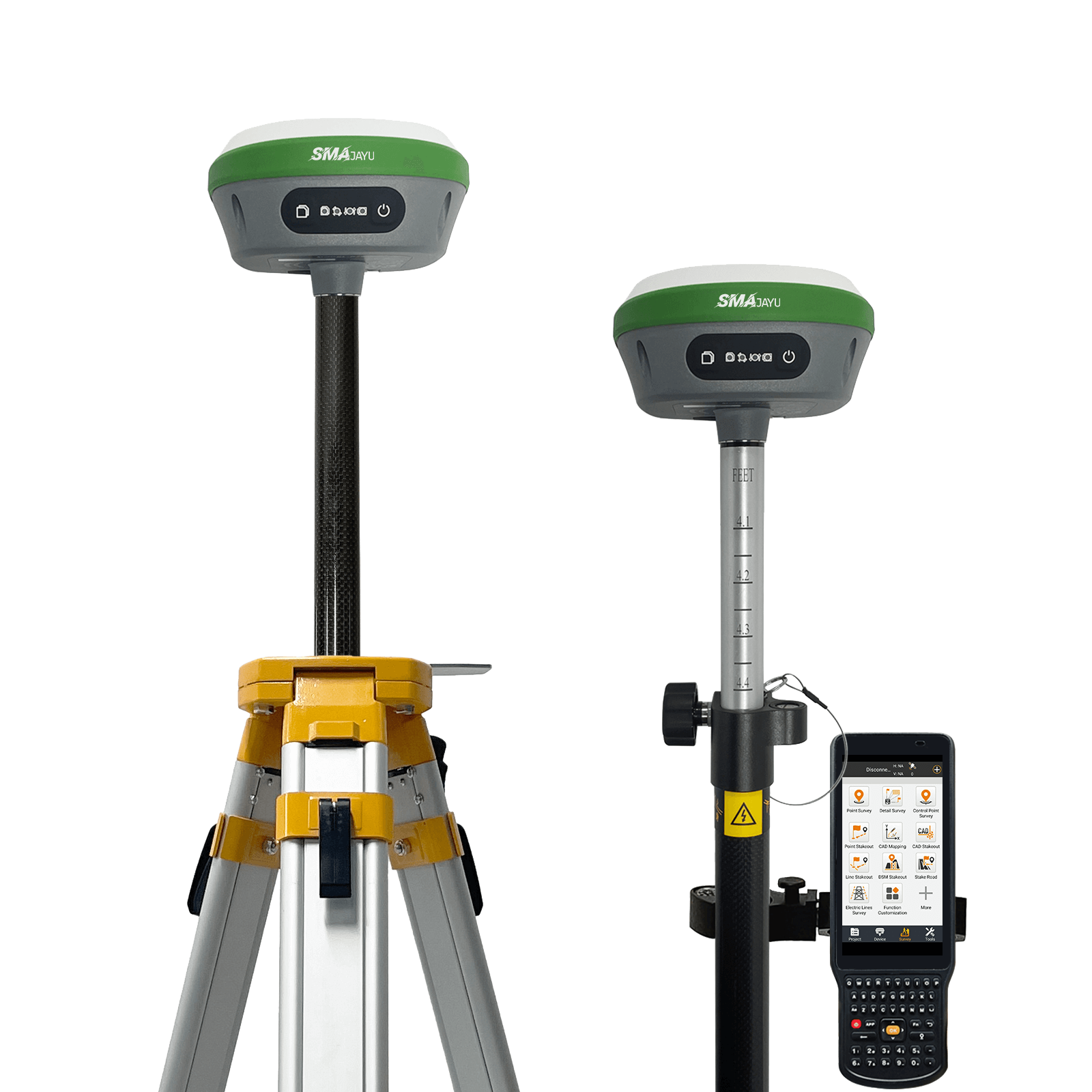
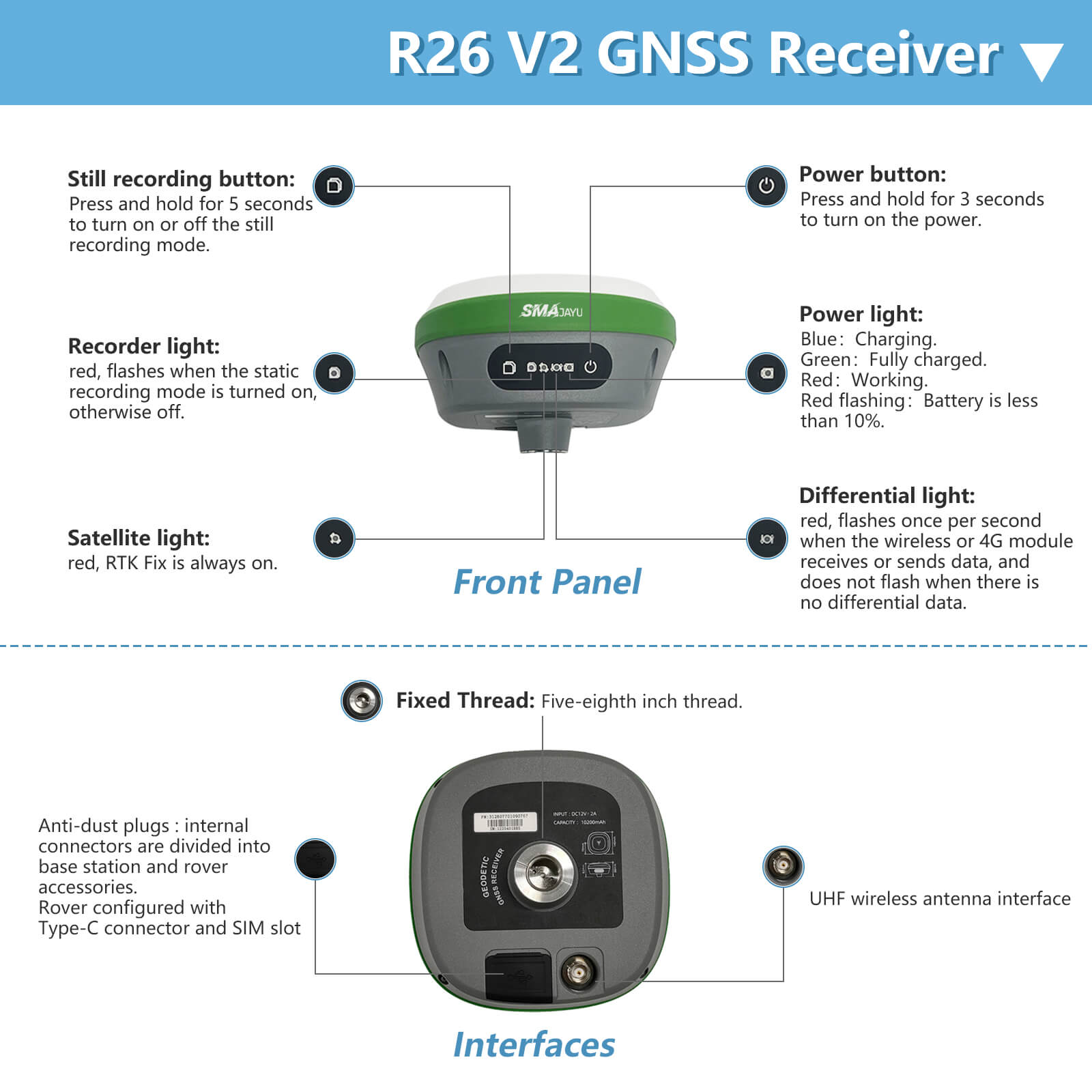
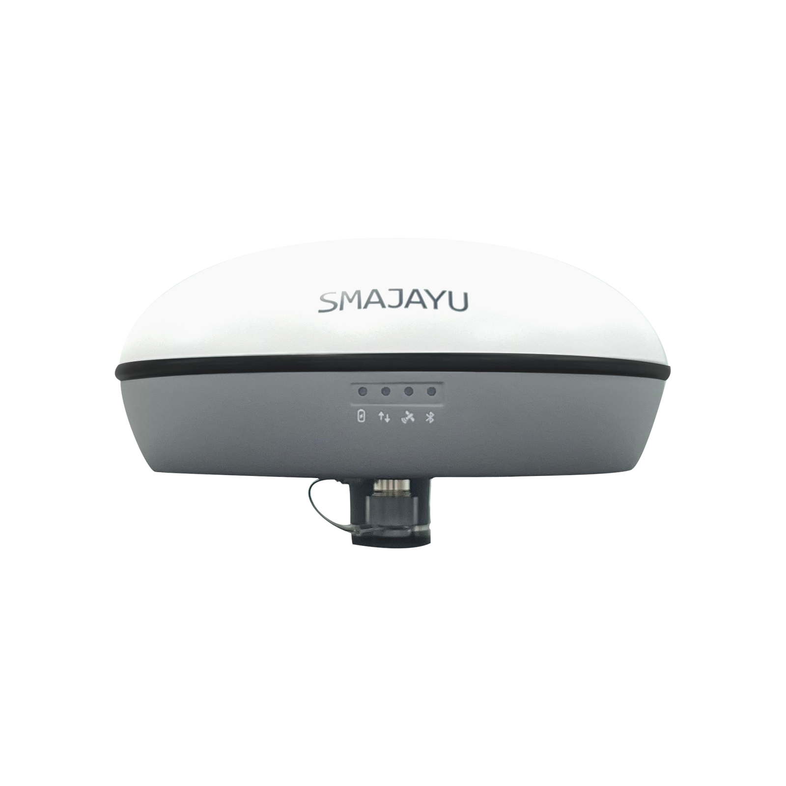
SMA26 GNSS IMU RECEIVER
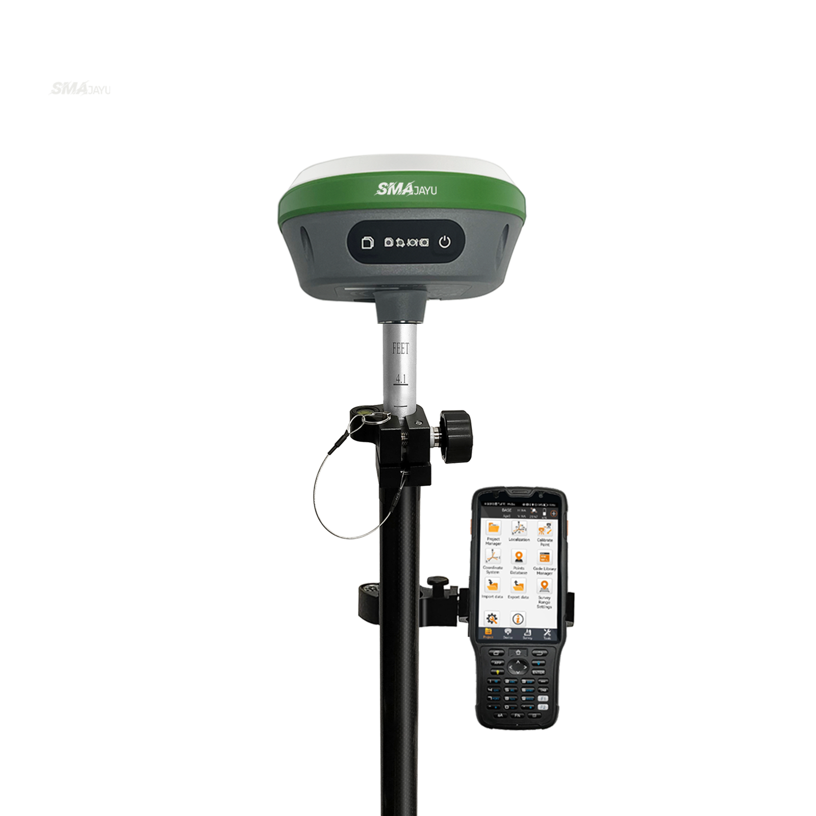
The SMA26 -V2 survey system is a survey system including Handheld; it integrates the advantages of high precision, low power consumption, small size, convenient and fast portability and operation. It can meet various engineering needs of surveying and mapping industries.
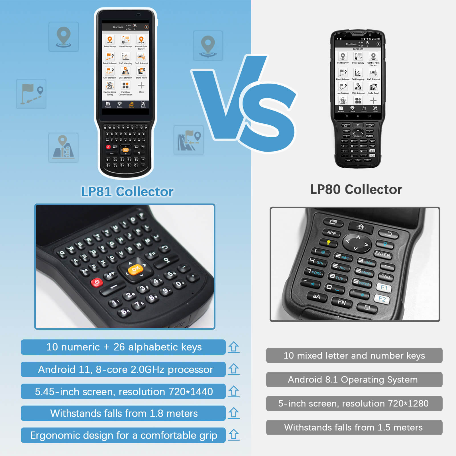
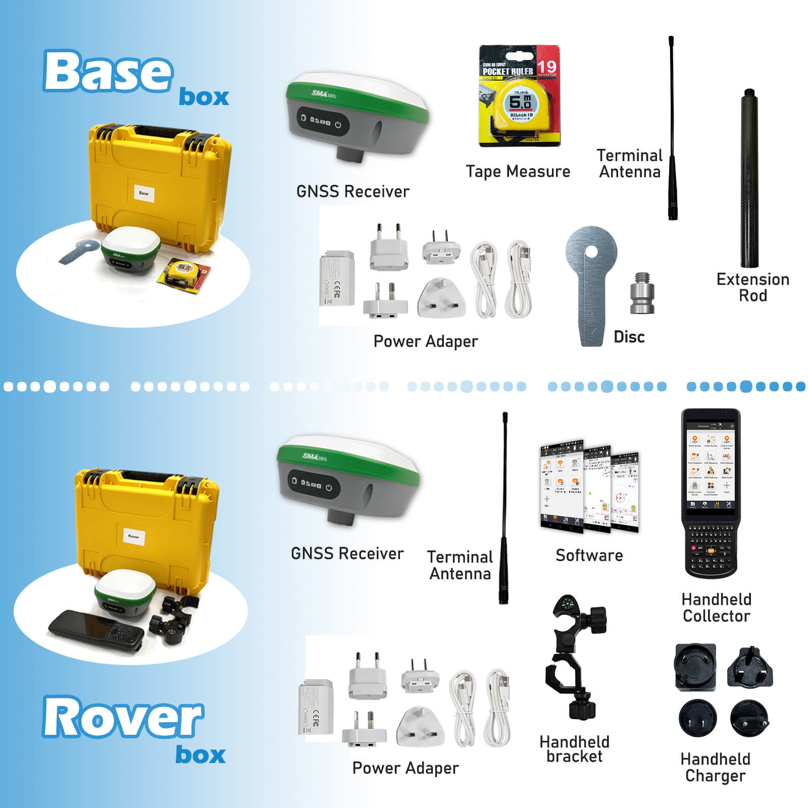
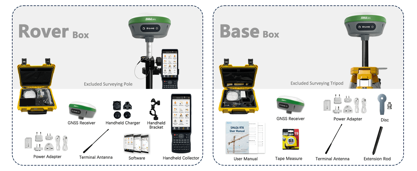
The system consists of two SMA26-V2 GNSS receiver and a Handheld, Handheld with surveying software.
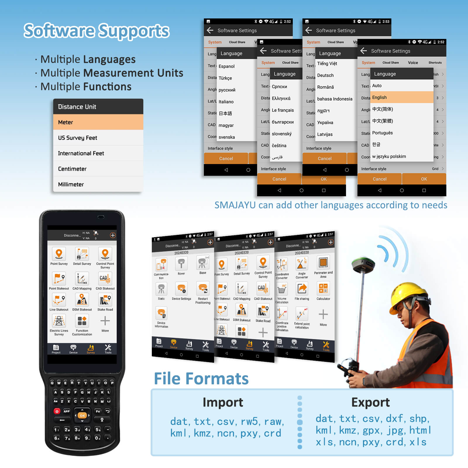
The software interface is clear, easy to learn and understand, convenient and practical, making work easier, faster and more efficient. It can be widely used in surveying and mapping industries such as land, construction, forestry, roads, electric power, water conservancy, oil pipelines, etc.
ENABLE GNSS RTK ANYTIME, ANYWHERE
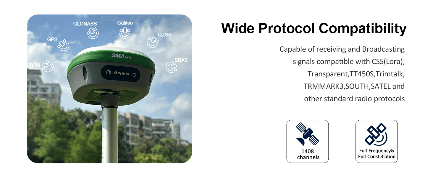
Full constellation,Strong battery life,RTK+IMU
Technical Feature
• Small volume and high integration, the system can integrate large capacity battery, inertial navigationmodule, GNSS antenna, satellite positioning module, Bluetooth, radio module, storage module, etc.;
• High precision and low power consumption, using Beidou, GPS, GLONASS, Galileo, QZSS and othermulti-system multi-frequency system, in a variety of positioning, to ensure the accuracy of complexenvironment;
• Support wide voltage 9~36V DC power supply, with positive and negative polarity reverse connectionprotection function;
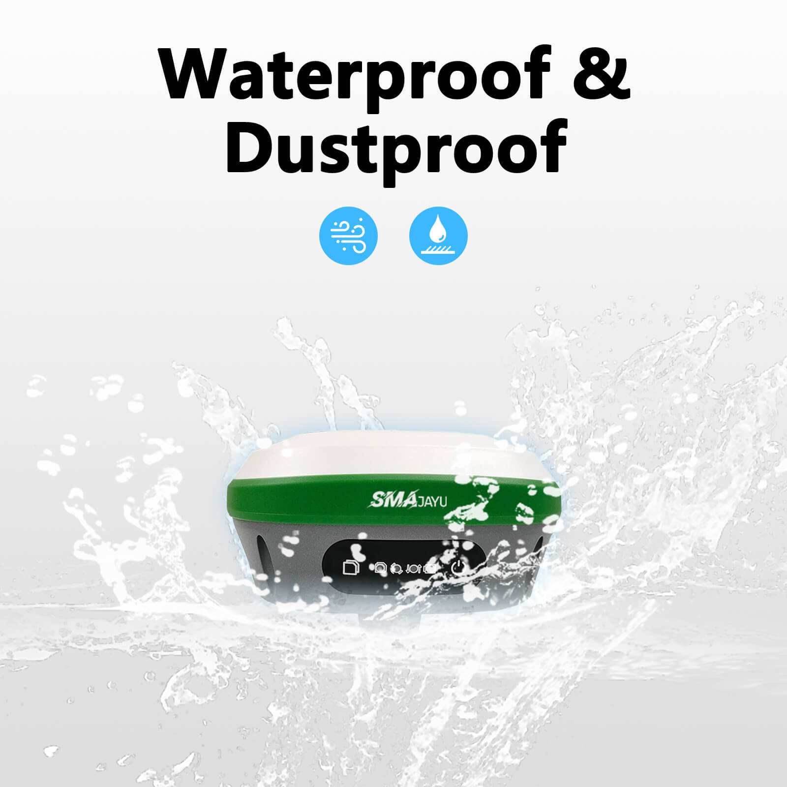
• Standard IP67 waterproof and dustproof design;
• Built-in Bluetooth module, compatible with 2.0 and 4.0, can send differential data;
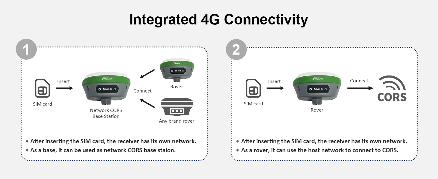
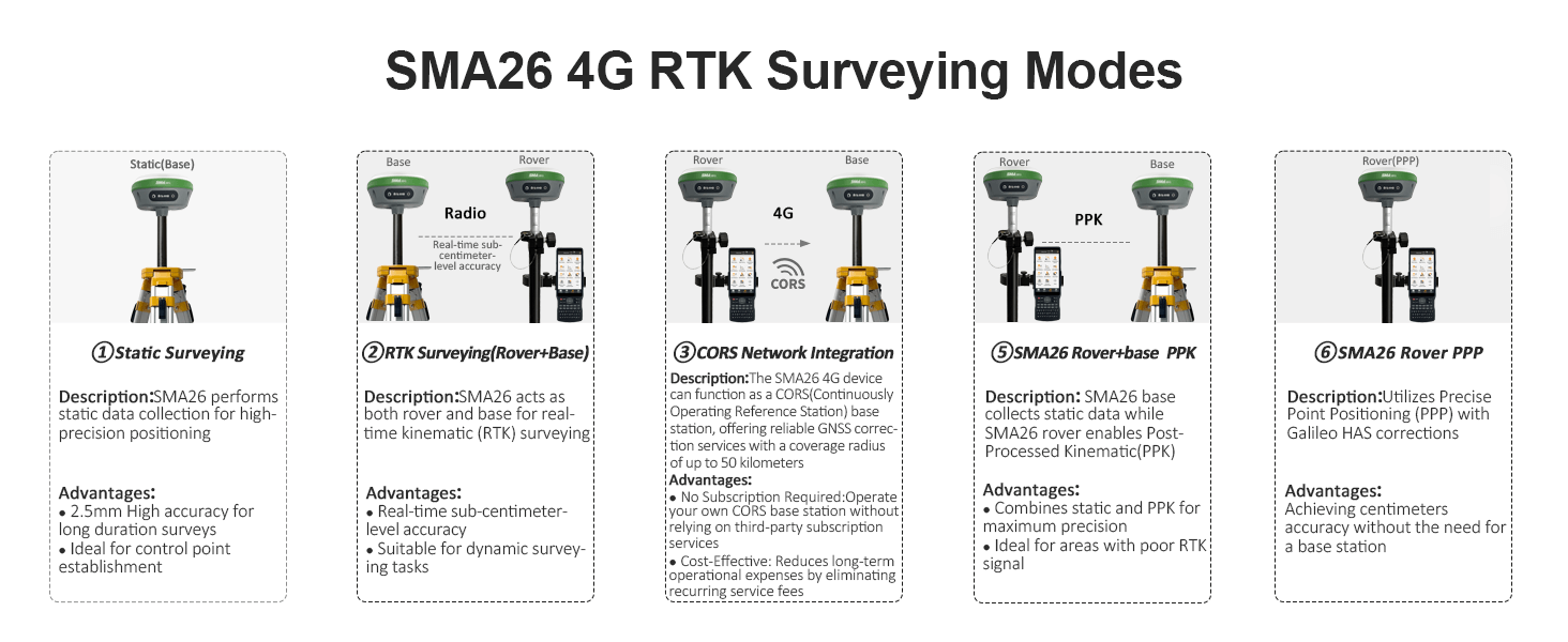
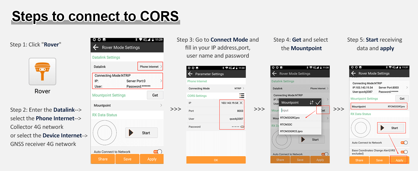
• Measurement software can realize CORS connection, measuring lofting and other functions;
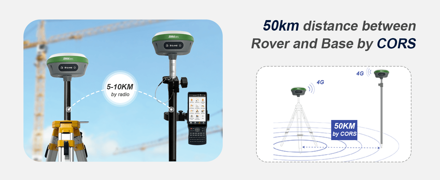
• Built-in integrated radio module supports various communication protocols, such as CSS (Lora)protocol; the maximum transmission power is 2W, can realize the maximum 5 km data communication;
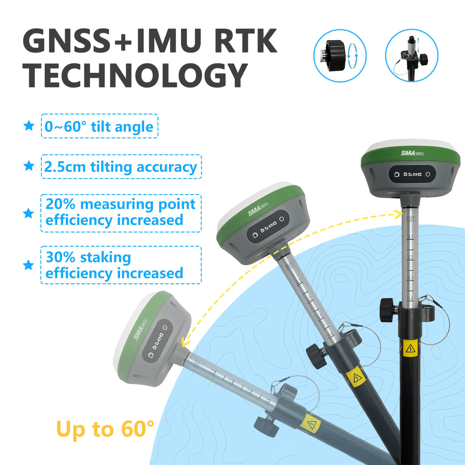
• Built-in inertial navigation module, fast calibration, to achieve the inertial navigation RTK function, usedfor tilt measurement;
• The base station and the mobile station can be interchangeable, and can be used as a base station oras a mobile station mapping;
• Built-in 8G large-capacity memory card, can be real-time storage of job data
-
R26 Base
0.67MB
-
R26 Rover
2.34MB
-
Static measurement Guide
0.30MB
-
R26 Survey Test
0.39MB
-
R26 RTK User Manual
6.81MB
-
R26-V2 survey system
2.09MB
Related Products

SMA26 4G RTK rover+base
$3290
x
Reply to you within 24 hours
