

With the assistance of the GNSS receiver, you can cut the time needed to complete a survey from months to only a few hours or days. The surveying profession was an early adopter of GNSS because of the obvious advantages it might bring to the field.
Experts in the field of surveying now use GNSS receiver for Surveying technology to provide trustworthy results to customers in a variety of fields and contexts. The use of GNSS technology in surveying is increasingly unremarkable.
What is GNSS surveying?
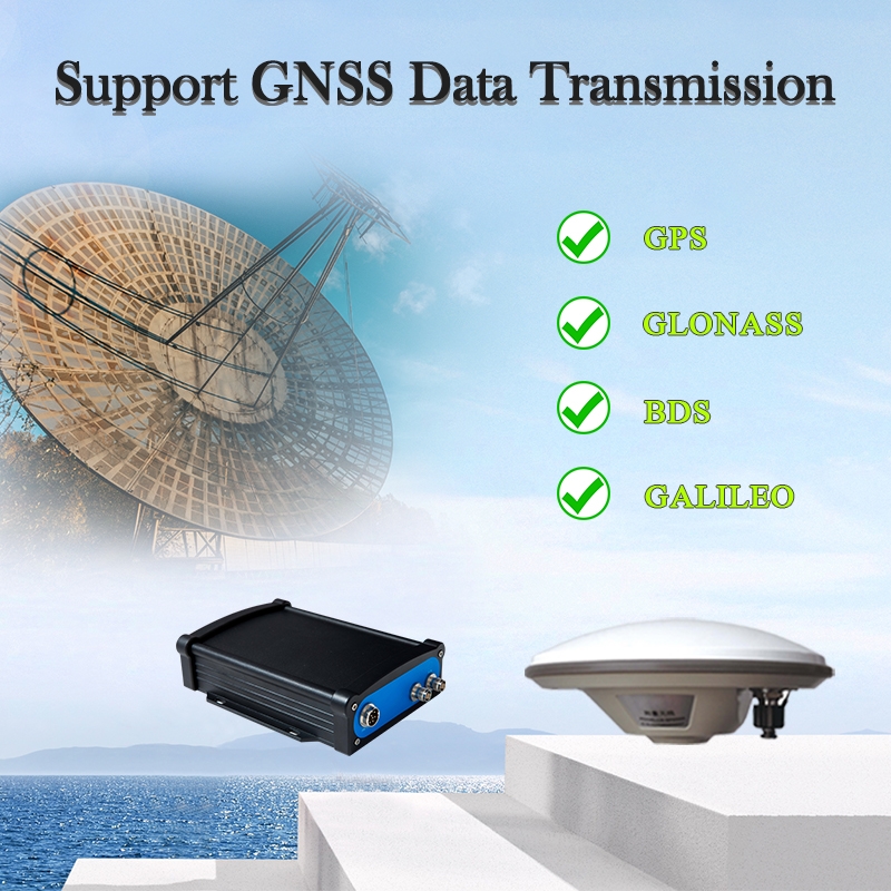
To learn how GNSS is used in surveying, one must first know what GNSS is. In a nutshell, GNSS is a navigational system that uses satellites to pinpoint your location. The military’s usage of GNSS dates back to its development, and the system became live. Since then, its use has spread across several industries and markets.
- To function, GNSS receivers must send signals to ground-based receivers. Four or more satellites in the system are in constant communication with each other and with any receiver that requests location information, each of which sends the receiver information about its own location, as well as the time and distance at which the data were transmitted.
- The receiver’s latitude, longitude, and altitude may be determined using data obtained from these satellites. If the receiver is in motion, its velocity may be determined by tracking its changing location over time, which can be accomplished by continuous data collecting. GNSS can triangulate the signal and pinpoint your position at any time of day or night, regardless of the weather or time of day.
- GNSS is a strong tool for business applications, and although most people are aware of it and have used it in some capacity on their smartphones or automobile navigation systems, it is still relatively unknown among the general public.
- The surveying profession may benefit greatly from it. When GNSS became available to the public, surveying was one of its earliest commercial uses due to the time and effort saved by not having to calculate latitude and longitude by hand. When combined with other surveying tools like the Total Station, GNSS technology gives surveyors invaluable data that they can use to create plans and models for their clients.
How is GNSS surveying is done?
- Technology: While the technology behind GNSS surveying is identical to that used in other GNSS applications, surveyors make extensive use of GNSS in ways that other users don’t. The two most important distinctions are in terms of technology and application.
- Data Usage: Rather than utilizing position data for navigation, as it would be in a standard navigation system, surveyors utilize the data they acquire via GNSS technology to measure distances between sites. For the purposes of the survey model, these measures are gathered, entered, and shown in a GIS.
Yet, how exactly do surveyors make use of GNNS units?
It depends on the precise GNSS surveying methods they use. While the fundamentals of GNSS are straightforward, surveyors make use of a variety of ways to get the most out of their data.
Benefits of using GNSS receiver for Surveying:
GNSS surveying are a fast and precise method of mapping and modeling the physical environment, from mountainous terrain to city skylines. Because of its adaptability and usefulness, GNSS surveying has become the industry standard. Government agencies, academic institutions, and private companies all employ GNSS surveying when they have a need for accurate location data. GNSS surveying provides several advantages to the following communities:
- Flexibility: GNSS surveying works even when it’s cloudy, unlike traditional methods of surveying. GNSS technology can still measure the locations of survey stations and deliver accurate location data even if they cannot see each other due to line-of-sight limitations or weather. It is especially beneficial for maritime navigation and construction when surveying coastlines and waterways with few land-based reference points.
- Mobility: GNSS devices are very mobile in that you can carry them within backpacks or place them on vehicles to gather data fast and over a broad region. They may also be used to navigate. Portable GNSS survey equipment, when used in conjunction with CORS systems, is capable of producing real-time data.
- Speed: In contrast to more conventional surveying methods, which includes a large amount of measurement and computing, the GNSS receiver for Surveying is very efficient. Today, it can provide practically instantaneous data and automatically compare that data to provide accurate results, often in minutes quickly. If survey teams have quicker access to the results, they can acquire them more rapidly, and if companies have speedier access to the data, they can make choices more swiftly.
- Accuracy: Whoever conducts the survey will wish for accuracy. Tools and/or staff that are not up to grade may have a substantial negative influence on accuracy. On the other hand, precision is always obtainable with the use of cutting-edge GNSS technology, professional supervision, and dependable software.
Because of these benefits, many firms rely on the expertise of GNSS receiver for Surveying.
Linking the GNSS survey data with 3D modeling:
When it comes to planning projects in almost any industry, GNSS survey data is linked with sophisticated 3D modeling to deliver comprehensive and useful data. In addition to helping with visualization and planning, the data produced for the 3D modeling of these projects may also be used to control construction machines depending on the requirements of the models. This can be a very useful use of the data.
In 3D machine control, positioning sensors are utilized to give input to machine operators. This input instructs machine operators on how to effectively run their machines to achieve their objectives. As a result of this breakthrough, the accuracy of the equipment used on construction sites should improve, which has the potential to completely transform how construction sites are administered.
Conclusion:
If you are interested in learning more about the GNNS machine control modeling services we provide, you can either visit our website or call us.
